|
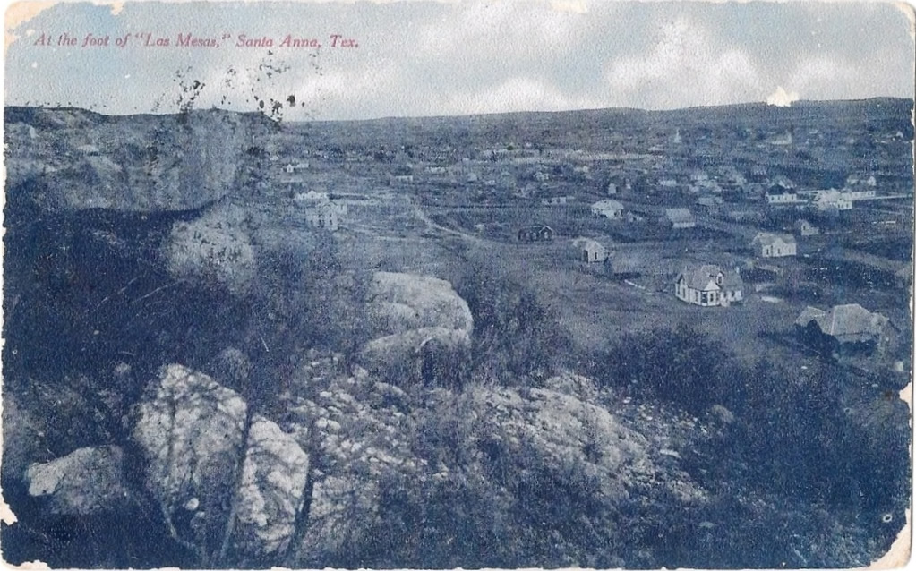
At the foot
of "Las Mesas", Santa Anna, TX, postmarked 1907
Click on image to enlarge
Old Photo
courtesy Dan
Whatley Collection |
Santa Anna and
Coleman have an excellent relationship.
You need one when you're only 8 miles apart. The local newspaper (The
Coleman Chronicle and Democratic Voice) serves both towns.
Santa Anna wasn't named after General Antonio Lopez de Santa Anna,
no matter what his relatives might tell you. The town was named after
the mountain, the mountain was named after the Comanche Chief,
Santana, who may or may not have been named after "The Napoleon
of the West."
The Santa Anna Mountains, or Peaks as they are sometimes
called, served as a sort of "switchboard" for the signal-fire network
that the Comaches used. They also were the point of impact for a meteorite
that the Comanches recovered and held sacred. Santa Anna (the Chief)
actually traveled to Washington-on-the-Potomac and met with then-president
Polk. |
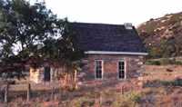
The first structure
in Coleman County (recently restored)
TE photo,
2000 |
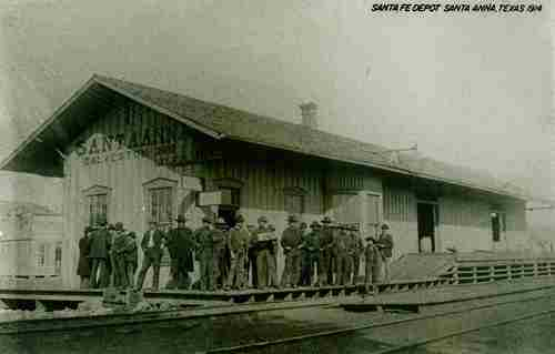
Santa Anna Santa
Fe Depot
Photo
courtesy Mary L. Irving, Curator, Martin & Frances Lehnis Railroad
Museum
More Texas
Depots |
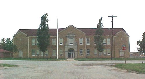
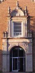
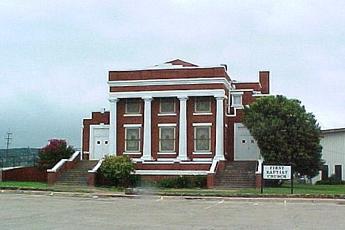
About
four blocks south of Hwy 84 you'll see the Santa Anna High School.
We were told by several people that the school was told they could
be placed on the State Register of Historic Places if they could replace
the windows back to the original wooden ones.
The
Santa Anna High School
TE Photo, 2000 |
 |
 |
 |
 |
Big Events
are unfolding in Santa Anna
The Santa Anna
Historical Development Organization has gone back into Santa Anna's
History even before settlement and has contacted the Tribal Leaders
of the Comanche Nation, now living in Lawton, Oklahoma. Several meetings
have already taken place, including cultural exchanges and a gift
of a quarter horse to the Comanche Tribe. The Comanches have declared
property owners of former Comanche lands to be caretakers for the
tribe.
The ongoing discussions will eventually produce a cultural museum
in Santa Anna. A restoration of the Old Sealy Hospital is proceeding
and this is the logical place for the museum. Eleven Comanche families
are considering putting their private collections on loan to the museum.
The Third Weekend in October is when Santa Anna puts on their
annual Frontier Heritage Festival.
Santa Anna is also home to the Texas Bison Grower's Association.
(See Bison) |
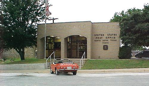
 |
Waiting is a
consideration in Santa Anna, where there's so much to enjoy.
TE Photo |
Santa Anna,
Texas Forum
Subject:
Lost Carvings of Santa Anna
I was born in the Santa Anna Hospital in 1933 and lived in and around
there until I left to join the Marines in 1953. My grandfather J.T.
Newman (12 children) farmed and ranched near �Leady� (now nonexistent)
which was on St. Rd. 2633 just North of the CR-16 cut off road to
Trickham. My other grandfather G. P. England ( 9 children) farmed
near Gouldbusk.
The large families of that day and time inter married and created
family relationships referred to as �Double Cousins� and there were
three such marriages within the Newman family. A brother-sister
Newman combination married a sister-brother combination from the
England family, the McClure family and from the Parish family.
The Newman Family began a custom of holding annual family reunions
in about 1932, which custom continues today. From an existing database
of some 400 descendants, an annual attendance of 100-125 participate
at Lake Buchanan for three days every July.
While growing up I first lived near and attended �Mukewater School�
(now nonexistent) which was a two room schoolhouse on the Trickham
Road (St. Rd. 1176) approx halfway from Santa Anna to Trickham.
There was also a gas station/grocery store run by the Bowden family
at the junction across from the school.
After moving to Santa Anna about 1940, I attended the old Grammar
School and later the existing Santa Anna High School. About 1944
we moved to an address at the corner of 8th St and Ave A which was
near the hospital and at the very south foot of the West Mountain.
While there, the Nurses� Residence (About 100 yards from our house)
burned to the ground. Also, a Coleman high school girl was killed
in a fall at an excavation about halfway up the west mountain directly
above our house.
About 1946 we moved to an address at 1st Street and Mountain Ave
which was also at the foot of the West Mountain and between this
new address and the immediate prior address. We lived almost ten
years at the base of the West Mountain and I spent many, many hours
roaming and exploring the mountain.
Some time after 1946, mining work to extract Silica Sand began again
at the eastern end of the west mountain and over the ensuing years,
many, mostly little known artifacts were destroyed or lost, likely
forever.
I am referring to relief carvings in the limestone caprock all of
which appeared to be quite old. They have to have been destroyed
by the mining operation unless by some chance they were preserved.
I will describe the carvings below: (Geographic co-ordinates approximated
from �Google Earth�)
1) On the South face of the Caprock at approx 31 deg,44 min, 50.05
sec North and 99 deg, 19 min, 17.65 sec West were two large relief
carvings.
a. A large (Approx 36� x 36�) Indian Chieftain with full feathered
headdress and the name �Nocona� chiseled beneath it.
b. A large United States Marine Corps emblem (Eagle, Globe and Anchor)
(Approx 36� x 36�) in relief and the inscription �In memory of my
Buddy Ollie� chiseled beneath it.
2) On the North face of the caprock at approx 31 deg, 44 min, 50.08
sec North and 99 deg, 44 min, 20.97 sec west (An area referred to
as an Indian holy place and/or Lover�s Leap) were more relief carvings:
a) A stylized Indian Swastika approx 18� x 18� (No wording)
b) What appeared to be a �Bag� gathered and tied at the top approx
14� high and 10 � wide (No wording)
c) Several �Doves Flying� (No wording)
The local legend intimated that the �Bag� represented treasure and
the direction of the flight of the doves represented the location
of the treasure. (I never did find it !)
I also remember the town�s members of the Texas National Guard returning
home from Europe following WW II on the train one day and the parade
that followed with them marching and pulling their small artillery
pieces along the main street. Later while I was still a HS student,
I joined the Santa Anna Unit �Tank Co, 142nd Inf, 36thDdiv� and
attended two summer camps with them. I was trained as a cook and
in 1949, went in a military truck to the top of the east end of
the west mountain before daylight on Easter Sunday to serve coffee
and doughnuts after an Easter Sunrise Service.
I sincerely hope that this offering stimulates many memories for
those who may have experienced those times and stimulates the curiosities
of the younger generations that follow. - Capt. Joe England USMC
(Retired), Victoria, B.C., Canada, February 13, 2007
|
| Texas
Escapes, in its purpose to preserve historic, endangered and vanishing
Texas, asks that anyone wishing to share their local history, stories,
landmarks and recent or vintage photos, please contact
us. |
|
|