|
Texas
Rivers | Pecos River
Pecos River
Views
by
Brewster Hudspeth
8 Photos by Fiddle Blue
4 Photos by Charlene Beatty Beauchamp |
Courtesy
Charlene Beatty Beauchamp
& Denise Doud |
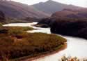
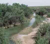
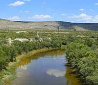
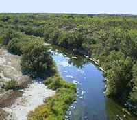
Pecos River North
of Sheffield
on I-10, East to Ozona
Photo Courtesy Fiddle Blue |
Pecos River
views at :
- Reeves/Loving
County Line
- Reeves/Ward
County Line
- Pecos/Crockett
County Line
- Pecos/Crockett
County Line
- Pecos/Crane
County Line
- Crockett/Terrell
County Line
- Where Pecos/Crockett/Crane
Meet
Unfortunately,
the confluence of the Pecos and Rio Grande is now
under water. The creation of Lake
Amistad means that the shoreline of the lake extends up the
river valley over 10 miles.
|
| Courtesy
Charlene Beatty Beauchamp |
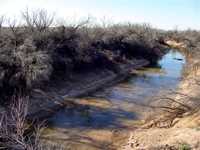
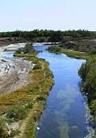
West Texas Photographer
Charlene Beatty Beauchamp, accompanied by Denise Doud
risked life and limb to supply these photos from the Ward / Reeves
County Line.
As you can see in the photos, the Pecos at this point is a fragile
stream. The photo is taken on highway 18 - just West of Grandfalls.
|
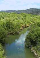
Pecos River
Ward County Line
Photo
Courtesy Charlene Beatty Beauchamp & Denise Doud |
|
Our other photos
of the Pecos come from Fiddle Blue, who caught the Pecos
outside of Sheffield,
Iraan and
McCamey.
Fiddle, who traverses West
Texas by motorcycle, also supplies photos of historic Castle
Gap.
|
|
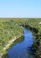
The Pecos River
From low water
crossing between Iraan
and Sheffield
Photo
Courtesy Fiddle Blue
|
|
The Pecos River
North of Sheffield
on I-10, East to Ozona
Photo
Courtesy Fiddle Blue
|
|
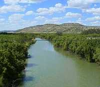
Pecos River
South of McCamey,
TX Hwy 305
Photo
Courtesy Fiddle Blue
|
|
Pecos River
East of Iraan,
Hwy 190
Photo
Courtesy Fiddle Blue
|
|
Pecos River
east of Sheffield,
Hwy 290
Photo
Courtesy Fiddle Blue
|
|
Pecos River
8 miles west of McCamey
on Hwy 67
Photo
Courtesy Fiddle Blue
|
|
Pecos River
west of McCamey
Photo
Courtesy Fiddle Blue
|
| Texas
Escapes, in its purpose to preserve historic, endangered and vanishing
Texas, asks that anyone wishing to share their local history, stories,
landmarks and vintage or recent photos, please contact
us. |
|
|