|
History in
a Pecan Shell
Prior to the Civil
War, the town had be named Dry Medio after the creek of the
same name. After the war the town was renamed to honor local citizen
John F. Pettus.
The town became a stop on the San Antonio and Aransas Pass Railway
in 1866 after J. S. Hodges donated land for platting the town. The
first reported population was a respectable 250 residents which were
served by no fewer than five stores and most essential businesses.
After oil was discovered in 1929 the population grew to 300 and has
slowly grown to 400 by 1990. In 2000 it had reached 608. |
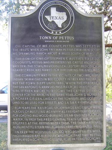 |
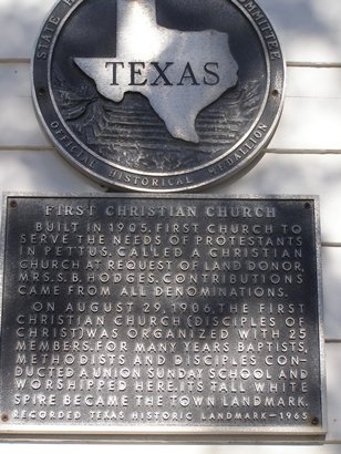
Historical Marker:
Town of Pettus
Oil capital of
Bee County, Pettus
was settled in the 1850's when John Freeman Pettus set up his sprawling
ranch about 4 miles south of here.
The son of one of Stephen
F. Austin's first
300 colonists, Pettus was an extensive cattle and horse breeder.
The town, previously called "Dry Medio" for a nearby creek, was named
for him during the Civil War.
The community was in the vicinity of two important Indian skirmishes
in Bee County in 1859
and the 1870's; but the town slept until 1886, when the tracks of
the San Antionio & Aransas Pass railroad reached this site. It then
awoke to become the cattle shipping center for the area. In the same
year, John S. Hodges, a pioneer citizen, laid out the townsite and
donated land to be used for streets and S.A. & A.P. right-of-way.
For years the railroad stockyards and depot were places of bustling
activity as freight trains came for loading and wood-burning steam
engines took on water. In 1909 the presidential train of Wm. H. Taft
stopped at the Pettus water tank. The tank--a final monument to steam
railroading here--was razed, 1965.
In 1929 the Houston Oil Co. brought in its well "No. 1-Maggie Ray
McKinney" and from that time Pettus has played a continuing useful
role in Texas economy. |
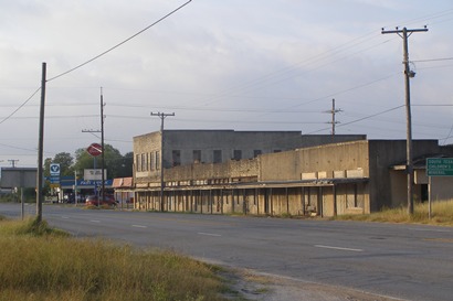
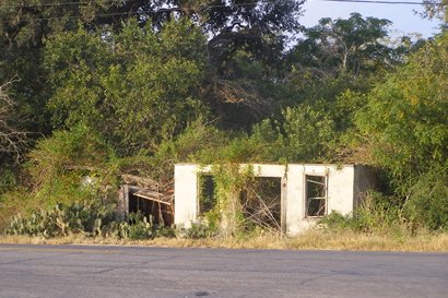
Pettus Today
Photographer's
Note:
Here are some photos of my old school town of Pettus, Texas. Once
an oilfield hub for the area, both sides of the road had many oilfield
service companies and you could smell the odor of oil as you pulled
into town. There were numerous Oilfield plants & oilfield camps in
the Pettus area as well. Most of what was left went away in the 1970's
to early 80's and as of today there are only 3 businesses left on
the main drag through town. A convenience store, a Dairy Queen, and
a Oilfield Supply Store.
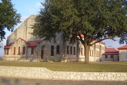
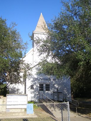
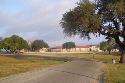
There are a couple of pic's of the High School which is set in among
many beautiful oak trees which only a few you can see in the pic's.
Several of the buildings were built of "Tuleta Rock". A local hard
caliche rock which was know to have many holes throughout giving it
character. Most of the rocks came from pits in the Tuleta
& Pettus area with a few buildings built with them being the Tuleta
Grade School & Mennonite Church in Tuleta,
the Boy Scout Hut in Sinton,
TX., and a couple of Pettus & Tuleta
Homes. - William
Beauchamp, October, 2008 |
 |
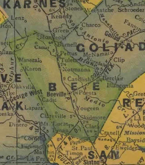
Bee
County 1940s map showing Pettus on the RR
From Texas state map #4335
Courtesy
Texas General Land Office |
| Texas
Escapes, in its purpose to preserve historic, endangered and vanishing
Texas, asks that anyone wishing to share their local history, stories,
landmarks and recent or vintage photos, please contact
us. |
|
|