|
 |
History in
a Pecan Shell
The community was
developed prior to the 1920s and was named for landowner James F.
Ray. The town prospered along with the cotton
boom and suffered when prices dropped. Both a Methodist and Lutheran
church were built in the mid-1920s and the town opened its first school.
In 1940 an electrical co-op was formed to bring electricity to the
region, but after WWII,
the towns decline was obvious. The school merged with those in Three
Rivers and the Methodist Church closed its doors. The Lutheran
Church started holding it�s services in Three
Rivers and Ray Point disappeared from most maps.
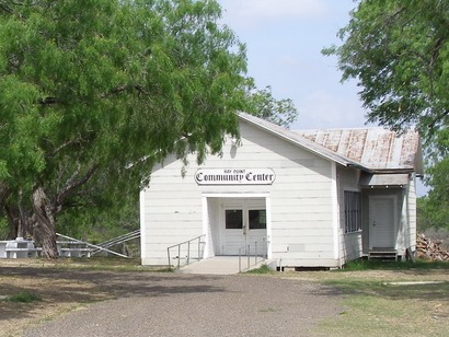
Uranium was discovered in the late 1960s and mining the mineral provided
some jobs, although the town never developed. The old Ray Point school
became the town�s community center. The 1990 population of 75 had
increased to 200 for the 2000 Census.
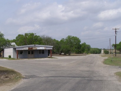
Photographer's Note:
Ray Point Texas is located on FM 1358 in mid-eastern Live
Oak County about 5 miles ENE of Three
Rivers, Texas. This community has always been active and evidenced
by the building of a new Community Center. Mostly a ranching community
with scattered residences. - Will
Beauchamp, April 26, 2009 |
 |
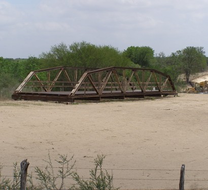
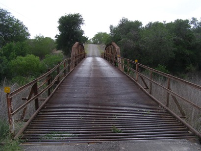
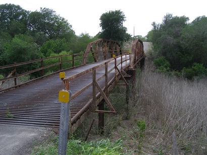
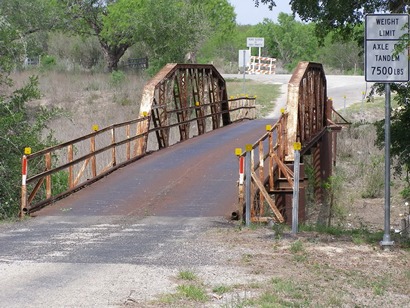
The Bridges
Photographer's Note:
The Ray Point community is set to lose part of it's history as two
local bridges are in the works to be replaced. I happened upon this
bridge already taken out just off HWY 72 and I was told it was for
sale. Luckily the 2nd bridge nearest Ray Point is still intact. I
was able to capture a few pic's before it's time comes to an end.
A nearby resident told me the bridges did have wood boards to drive
across. When they began to rot the local County commission replaced
the boards with piping. It was said they gave him a hard time about
the bridges when the freezing wet temperatures came and ice kept anyone
from driving across them. The problem was solved when the pipe had
beads welded across the pipe to make the ice break up when driven
across. - Will
Beauchamp, April 25, 2009 |
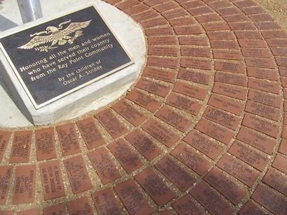
Ray Point Community
Center Memorial
Photo courtesy Will
Beauchamp, 2009 |
| Texas
Escapes, in its purpose to preserve historic, endangered and vanishing
Texas, asks that anyone wishing to share their local history, stories,
landmarks and recent or vintage photos, please contact
us. |
|
|