|
|
Town Lake is
the most stable portion of the Highland
Lakes chain, and in my opinion, Austin
just wouldn't be Austin
without it. To me, Town Lake is the heart of Austin.
The little camp called Waterloo that grew into Austin
began right where the Congress Avenue Bridge is today. The Colorado
River and all of its resources allowed Austin
to grow into a thriving metropolis. The river has also divided north
and south Austin for decades. When I have visitors from out of town,
I tell them we're going to Town Lake, but when we get there they say,
"Why, this is just a river!" Town Lake actually is a lake, created
by the City of Austin in
the 1960s as a cooling pond for the Holly Street Power Plant, with
Tom
Miller Dam and Longhorn Dam containing the water. Town Lake Metropolitan
Park extends the entire length, five miles, on the north and south
shores. The park includes seventeen ball parks, places to rent rowboats,
canoes, kayaks and paddleboats, swimming pools, volleyball courts,
picnic tables with grills, and lots of great scenery.
Cold Springs near Deep Eddy is a source of water for the lake. Today
it is covered by Town Lake but it still flows and can only be seen
by boat. It's on the south shore between Red Bud Isle and MoPac. A
man-made pool has been built under a 100-foot waterfall.
Sailing and canoeing are permitted on Town Lake, but swimming and
powerboats are not. However, you can swim in several swimming pools
in the park within a stone's throw of the lake. |
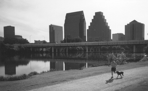 |
The
hike and bike trail in Austin
Photo courtesy Chandra Moira Beal |
| A popular feature
of Metropolitan Park is a 10-mile hike and bike trail. The gravel
and concrete trail begins at Riverside Drive and Congress Avenue,
near the Hyatt. It goes west past Auditorium Shores, which has parking
and rest rooms; Butler Shores, which also has parking; Zilker
Park (includes a short skirt around Barton
Creek); and crosses under MoPac, which also has a rest room. From
there it is a short jog west to Deep Eddy where there is a shower;
past Austin High School; across Lamar Boulevard; past Shoal Beach
and the Buford Tower; past the trailhead to the Shoal Creek Greenbelt;
and across South First and Congress Avenue Bridges. It intersects
with Waller Creek Walkway, goes under IH35, past Festival Beach, Martin
Pool and the U.S. 183 Bridge and follows Lakeshore Boulevard until
it ends about one-half mile west. The trail crosses the river via
footbridges at MoPac, South First Street, South Congress Street, and
the frontage road of IH35. |
 |
On the North
Shore of Lady Bird Lake:
Holly
Beach
A small 2.5-acre park between Longhorn Dam and Metz Park.
Fiesta Gardens
Popular for Hispanic celebrations, this sixty-acre park also has displays
of exotic flora and a lagoon. Fiesta Gardens also has a boat launch
and lots of open grassy space.
Waller Beach
Twenty-six acres of grassy park between IH35 and Congress Avenue.
The park is filled with gazebos, boat launches and docks.
Congress Avenue Bridge
Built in 1910. A relief exhibit at the intersection of Congress Avenue
and East Cesar Chavez (north of the river, in the southwest corner)
shows Austin as it looked in 1889. It is displayed from the perspective
as it would have appeared had you been standing in the same spot in
1889.
South First Street Bridge
Also known as the W.F. Drake, Jr. Bridge. Drake was mayor of Austin
between 1951-1953.
Shoal Beach
An eighteen-acre stretch between Congress Avenue and Lamar Boulevard.
This section includes Buford Tower, dedicated in 1978 to Fire Department
Captain James T. Buford for giving his life in the line of duty to
the citizens of Austin during a water rescue. Buford Tower was originally
built in 1930 as a training place for Austin's firefighters.
Lamar Beach
Extends from Lamar Boulevard to Johnson Creek. This forty-acre park
includes several ballfields.
University Beach
Parallels the University of Texas property west to Red Bud Trail and
has one acre of lake access.
Red Bud Isle
Thirteen acres of primitive wilderness just below Tom
Miller Dam. It is literally an island; you can picnic and access
the lake from a circular drive of very rough road.
Emmett Shelton Bridge
This bridge was the first low-water bridge over Town Lake. Originally
built in 1849, it was the gateway to the foothills west of Lake
Austin. Shelton is an attorney, author, land developer, marine
captain, community benefactor, historian, and poet. There is a historical
plaque just west of the bridge with an original block of Texas red
granite that was part of the first dam built on Lake
Austin in 1893 and destroyed by the flood of 1900. Portions of
the bridge remain submerged by the water.
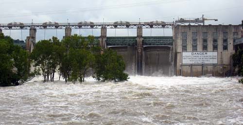
Tom
Miller Dam
Finished in 1940, this was the third dam built in this spot, the previous
dams having been destroyed by flooding of the Colorado River. The
dam is accessible from Lake Austin Boulevard at Red Bud Trail. Tom
Miller was mayor of Austin. |
 |
On the South
Shore of Lady Bird Lake:
Longhorn
Dam
Has scenic overlooks and picnic areas.
Lake Shores
Thirty-five-acre undeveloped park east of the Kasuba property to Pleasant
Valley Road.
Auditorium Shores
A popular gathering place for free concerts and other public festivals.
It is a flat, grassy area from the South First Street Bridge to Lamar
Boulevard. Twenty-five acres in all, it has a gazebo, a reflection
pool, and numerous rest areas.
Butler Shores
Named for Roy Butler, mayor of Austin
in the early 1970s. Butler Shores has parking and is adjacent to the
Parks and Recreation Department headquarters. It extends from the
Lamar Bridge to Barton Creek, and has seven acres of lake frontage.
For a spectacular view of Town Lake and Austin's
skyline, check out Lou Neff Point located in Zilker
Park. Isabella Neff was the namesake of the very first state park
in Texas, and Lou Neff is a relative.
As of this writing, Austin
is considering converting Town Lake Park into a performing arts center,
parking garage, and park land. |
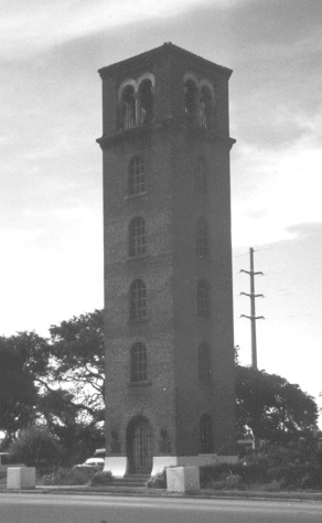 |
Buford Tower
Photo courtesy Chandra Moira Beal |
BATS
A discussion of
Town Lake would not be complete without a word about the bats. Between
April and October, North America's largest urban colony of Mexican
freetailed bats make Austin
their home. More specifically, they live under the Congress Avenue
Bridge and can be heard squealing as you walk under it. Hundreds of
people gather on the bridge or shores to watch the colony, literally
millions of bats, leave in a swarm at dusk to devour mosquitoes and
other insects. The Austin America Statesman has set up a grassy beach
and informational stand for viewing from the south side of the bridge.
Another way to watch the bats is from your table at the Shoreline
Grill. August is the prime month for viewing.
http://www.batcon.org/
Excerpted from Splash
Across Texas, 1999
Copyright Chandra Moira Beal and La Luna Publishing
|
|
|