|
First impressions
might be important, but the ones that last are priceless� - A. Nonymous
III
Once
upon a time, when the river was still flowing, when there were mammoth,
giant
bison, camel,
tortoise,
dire wolf and sloth roaming the Llano Estacado, the river was the
trail. As the bed of the North Fork of the Brazos River became sandhills,
draws became the drainage system for the region. Trails were formed
by these animals,
traveling between the lakes on these draws, seeking water. The earliest
inhabitants, the Clovis hunters, also needed water, as well as food.
They followed the trails - hunting, along the way, all the animals
that made them.
Through centuries of use by the ciiblores, commancheros, military,
mail routes and cattle
trails, the trails became a bit deeper with a wider impression on
the land. |
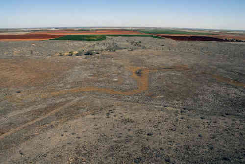
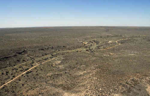
Once
Upon A Time The River Was The Trail
Photo courtesy Rick
Vanderpool, 2010 |
In the early
twentieth century large ranches
became farms. Soon others, mounted on horses,
often accompanied by wagons pulled by oxen
or mules,
discovered these trails and used them for similar purposes � hunting,
food and water � but also for exploration
and eventually, settlement. And with the creation of towns,
many of the trails became roads, while others, because windmills
now supplied the water, fell into disuse.
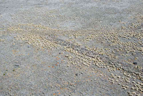
As the broad plains and sandhills were parceled, fenced and cultivated,
any trail that did not make a convenient road was simply plowed or
scraped away, leaving only the faintest trace of all the traffic it
once bore � a trace barely visible to anyone less resourceful and
dedicated to locating them than Sami Simpson.
Please pardon me, dear reader, but I had to fast forward to today,
April 8, 2010 � the day that, thanks to Sami's son's friendship with
helicopter pilot extraordinaire, Wally Moyers, Sami, Darwin McBee
and yours truly did take to the skies in Wally's lovely red chopper
to find and photograph those traces of trails � two of them that Sami
had painstakingly [with the help of GOOGLE Earth] marked on maps,
also providing Wally with precise GPS coordinates.
So, there we were, on a clear, blue, and I would like to add, CRISP
to the description of this special West Texas morning, since Wally
had removed the door on my side to allow for better photographs, and
to better enjoy the balmy temperatures in the 40's. But the infinite
colors and textures of the landscape below made us forget the chill.
We flew over birds,
hawks, deer,
coyote,
antelope, cattle
and horses;
farms, feedlots, ruins, junk, alkali lakes and streams; roads, fences,
fields and homes. |
 |
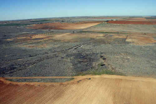
| We were all equipped
with headsets and microphones, but we didn't talk much, zipping along
at 90 mph (ground speed), at an altitude of 700 feet, in Wally's chopper,
looking for traces of a section of the Mackenzie
Trail traveled by Capt. Viele, August, 1875, starting at the
Lamb and Hale
County line, and a section of the Fort Sumner Trail from
the New Mexico border in Bailey
County, Texas, southeast, through Bailey, Cochran
and Hockley Counties
to Shallowater in Lubbock
County. Wally was navigating and piloting, Sami was checking her
maps and scanning the ground; Darwin was scanning the ground, and
while I was scanning too, there was that missing door� |
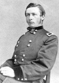
Ronald S. Mackenzie
Photo courtesy Wikipedia Commons |
Roughly 200 photographs
barely do justice to our amazing experience. It truly was one of those,
"you had to be there" deals. Over lunch, Sami, Darwin and I agreed
that the "poetry" of our experience would stay with us forever. Each
of us could imagine the first hunters following the herds of bison,
Mackenzie and his soldiers pursuing the Comanches and Kiowas who had
left the Indian Reservation, as the settlers followed in waves, mostly
passing through. We knew that while all those activities left the
impressions we could now see only traces of, the land itself had left
the most lasting impression on all who traveled it � back then, by
foot, horseback or wagon, and even today, by helicopter.
© Rick
Vanderpool
Texas Plains Journal, 6-26-10 |
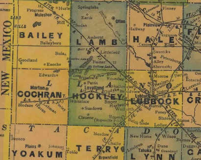
1940s map showing
Bailey, Cochran
and Lamb Counties
From Texas state map #4335
Courtesy Texas General Land Office |
|
|