|
In 1909 a two-teacher
school was built but no population count is available for the community.
It�s reported that Mount Pleasant had a church, school, and �a number
of scattered dwellings� in 1940. Today only the scattered dwellings
remain � and the fortress-like Castle Peak.
Photographer�s Note:
�As you can see there is not much here but from the THC markers it
is evident that there once was.�I visited with a man for a few moments
and he told me that he had been told that there was once a school
here but didn�t know anything else about the history of the town.�
� Gerald
Massey, July 2010 |
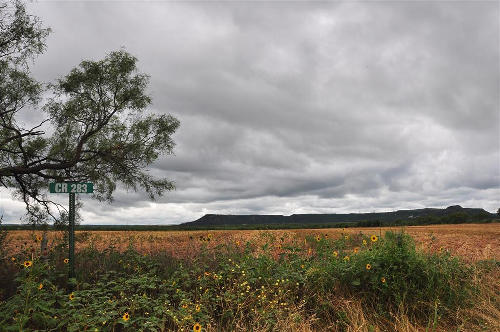
Windmill
and Cactus in Mount Pleasant
Photo courtesy Gerald
Massey, June 2010 |
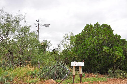
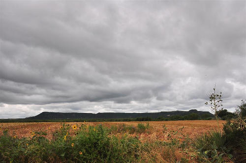
Castle
Peak & Indian Fight Historical Markers in Mount Pleasant
Photo courtesy Gerald
Massey, June 2010 |
Historical Marker
:
Castle Peak
The Butterfield
Overland Mail, the first public transportation facility spanning the
area from the Mississippi to the Pacific with passenger and mail service,
1858-61, used the 2400-foot peak to the northeast as a beacon. The
drivers and passengers viewed it for 30 to 40 miles. In that era it
was called Abercrombie Peak, for Colonel J. J. Abercrombie
of the U.S. Army, active in defense of this frontier. Waterman Ormsby,
a newspaper reporter riding the first Butterfield Stage to pass this
way, noted that the peak resembled a fortress. Later the height was
renamed Castle Peak.
(1968) |
 |
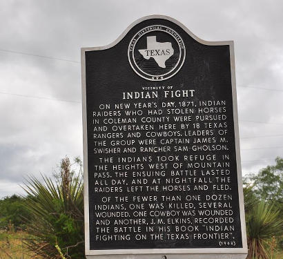
Historical Marker
:
Vicinity of
Indian Fight
On New Year's Day,
1871, Indian raiders who had stolen horses in Coleman County were
pursued and overtaken here by 18 Texas Rangers and cowboys. Leaders
of the group were Captain James. M. Swisher and rancher Sam Gholson.
The Indians took refuge in the heights west of Mountain Pass. The
ensuing battle lasted all day, and at nightfall the raiders left the
horses and fled.
Of the fewer than one dozen Indians, one was killed, several wounded.
One cowboy was wounded and another, J. M. Elkins, recorded the battle
in his book, "Indian Fighting on the Texas Frontier."
(1968) |
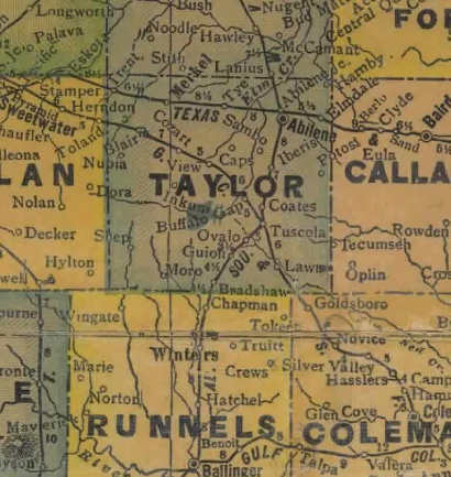
1940s Taylor
County map showing Merkel
(in NW Taylor County)
From Texas state map #4335
Courtesy Texas General Land Office |
| Texas
Escapes, in its purpose to preserve historic, endangered and vanishing
Texas, asks that anyone wishing to share their local history, stories,
landmarks and recent or vintage photos, please contact
us. |
|
|

 Texas
Gulf Coast
Texas
Gulf Coast East
Texas
East
Texas Central
Texas North
Central
Texas North Central
Texas South
Central
Texas South Texas
Panhandle
Texas
Panhandle South
Texas
South
Texas Texas
Hill Country
Texas
Hill Country West
Texas
West
Texas Texas
Ghost Towns
Texas
Ghost Towns Texas
Counties
Texas
Counties