|
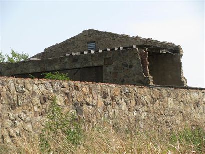 |
History
in a Pecan Shell
Settlement began during the Civil War when the absence of men created
a serious Indian threat. Twenty-five families attempted to start a
community here in 1864, but were hit by a devastating drought. The
settlers moved to more hospitable regions and the site sat uninhabited
for fourteen years.
Finally, Brothers C. O. and J. Q. Burnett settled near the ruins of
the would-be town, naming it after the creek of the same name.
A post office was soon granted and the community grew to 200 residents
by the mid 1890s. The next figures available (1914) showed a decline
to 125, and falling below that in the mid 1920s.
The post office closed in the mid 1950s, but Buffalo Springs continues
to be on the map. Population fell to 60 by the mid-1960s.
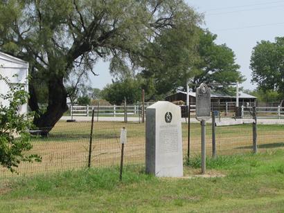
Buffalo Springs Historical
Marker
Buffalo Springs 1936
Centennial Highway Marker |
Markers on the
junction of FM 174 and FM 3077
Photo courtesy Mike
Price, September 2009 |
1936 Buffalo
Springs Centennial Highway Marker
Photo courtesy Mike
Price, September 2009 |
1936 Buffalo
Springs Centennial Marker
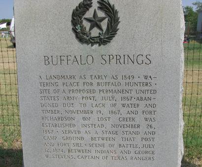
"A landmark
as early as 1849. Watering place for buffalo
hunters. Site of a proposed permanent United States Army post, July,
1867. Abandoned due to lack of water and timber, November 19, 1867,
and Fort Richardson
on Lost Creek was established instead, November 26, 1867. Served as
a stage stand and camp ground between that post and Fort Sill. Scene
of battle, July 12, 1874, between Indians and George W. Stevens, Captain
of Texas Rangers." |
Buffalo Springs
Historical Marker
33.556475,-98.139856
Photo courtesy Mike
Price, September 2009 |
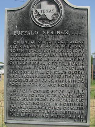
Historical Marker
Buffalo Springs
C.S.A.
"On line of
sentry forts along Red River and far frontiers of North
Texas, 1861-1865. Used at intervals by cavalry, especially at
such times as 1864 massing of 3,000 federals to the north, in Indian
territory. Soldiers here saw little of war's glory, had large share
of fighting and shortages of guns, ammunition, food, clothing and
horses.
Site of "forting up" of families wishing to stay, with goods and stock,
near frontier homes; lived in picket houses in fortified square, placing
guards on water or wood gathering parties; in 1862 left during water
famine." |
| Texas
Escapes, in its purpose to preserve historic, endangered and vanishing
Texas, asks that anyone wishing to share their local history, stories,
landmarks and recent or vintage photos, please contact
us. |
|
|