|
SURFSIDE BEACH,
TEXAS
AKA Surfside
Brazoria County,
Texas Gulf Coast
28� 57' 7.69" N, 95� 17' 3.89" W (28.952136, -95.284415)
On the Gulf of Mexico at the end of Highway 332
7 Miles E of Freeport
19 Miles SE of Angleton the county
seat
ZIP code 77541
Area code 979
Population: 579 Est. (2019)
482 (2010) 763 (2000) 611 (1990)
Book Hotel Here › Freeport
Hotels |
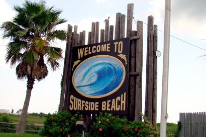
Welcome to Surfside
Beach
Photo
courtesy Ken
Rudine, July 2007 |
History in
a Seashell
Besides being the
mouth of the lengthy Brazos River, Surfside also surrounds the former
limits of what was Velasco. Prior to the Great
Storm of 1900, Surfside was a very popular resort of inland Texans
who needed to cool off during the summer months. The Surfside Hotel
- one of the largest and grandest of the resort hotels survided the
hurricanes but eventually burned to the ground. Surfside remained
mostly a beach until WWII
when it was included in the newly designated "Brazosport Industrial
Complex."
From a 1950s population of 1,208, it reached its high-water mark in
the 1970s with a population of 2,300. The town incorporated under
the name Surfside in 1975 but was renamed Surfside Beach
in the late 1980s. By the late 80s the population had shrunk to a
mere 604. It rose to 763 in 2000, but declined again to 482 in 2010. |
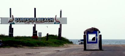
Surfside Beach
Photo
courtesy Ken
Rudine, July 2007 |
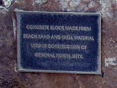
"Concrete
block made from beach sand and shell material used in construction
of original north jetty."
Photo
courtesy Ken
Rudine, July 2007 |
Gulf Intracoastal
Waterway historical marker
Photo
courtesy Ken
Rudine, July 2007 |
Historical Marker:
SH 332, 1 block south of Intracoastal Waterway
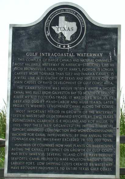
Gulf Intracoastal
Waterway
This complex of
barge canals and natural channels — most valuable waterway in
America — stretches 1,116 mi. from Brownsville,
Texas, to St. Mark's, Florida. Is longer, carries more tonnage
than Suez and Panama canals. Is a vital link in economy of Texas and
has been one of main causes of rapid development of Gulf Coast area.
The canal system was begun in 1854 when a short canal was built from
Galveston Bay to mouth of Brazos River as aid to Texas trade; it was
50 ft. wide, 3.5 ft. deep and dug by hand-labor and mule teams. Later
projects widened, lengthened canal along the coast.
Most important period in growth of the waterway system was result
of determined efforts by two Texas businessmen, Clarence S. E. Holland
and Roy Miller. In 1905-07 these men organized the initial financial
support, arranged construction and won congressional backing for canal
improvements. By 1966 annual total tonnage of the waterway exceeded
78,500,000 tons.
Hundreds of companies now have plants or warehouses along the canal.
It's impact on growth of gulf coast has been immense. Several inland
cities have become seaports. Canal helped to make Houston
nation's third largest port. Low shipping costs created by waterway
have brought prosperity to entire Texas
gulf coast.
(1967) |
 |
Old Velasco,
C. S. A. historical marker
Photo
courtesy Ken
Rudine, July 2007 |
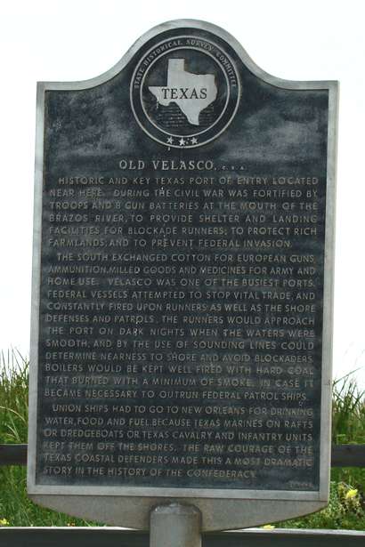
Historical Marker:
SH 332, 1 block south of Intracoastal Waterway
Old Velasco,
C. S. A.
Historic and key
Texas port of entry located near here. During the Civil War was fortified
by troops and 8 gun batteries at the mouth of the Brazos River, to
provide shelter and landing facilities for blockade runners; to protect
rich farmlands; and to prevent Federal invasion.
The South exchanged cotton for European guns, ammunition, milled goods
and medicines for army and home use. Velasco was one of the busiest
ports. Federal vessels attempted to stop vital trade, and constantly
fired upon runners as well as the shore defenses and patrols. The
runners would approach the port on dark nights when the waters were
smooth, and by the use of sounding lines could determine nearness
to shore and avoid blockaders. Boilers would be kept well fired with
hard coal that burned with a minimum of smoke, in case it became necessary
to outrun Federal patrol ships.
Union ships had to go to New Orleans for drinking water, food and
fuel, because Texas marines on rafts or dredgeboats or Texas cavalry
and infantry units kept them off the shores. The raw courage of the
Texas coastal defenders made this a most dramatic story in the history
of the Confederacy.
(1964) |
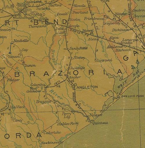 |
Brazoria
County 1907 postal map showing Velasco
From Texas state map #2090
Courtesy
Texas General Land Office |
| Texas
Escapes, in its purpose to preserve historic, endangered and vanishing
Texas, asks that anyone wishing to share their local history, stories,
landmarks and recent or vintage photos, please contact
us. |
|
|