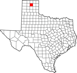
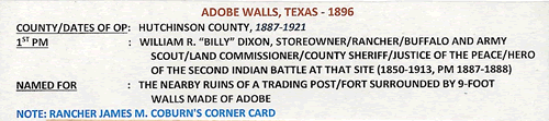
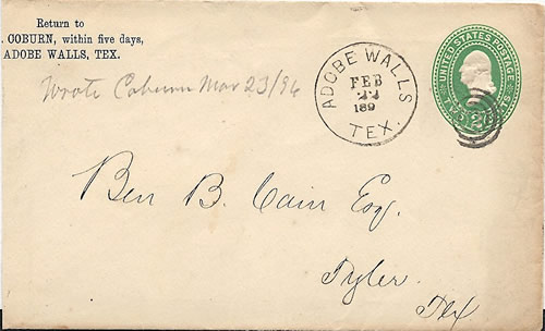
|
Ranch in Adobe
Walls
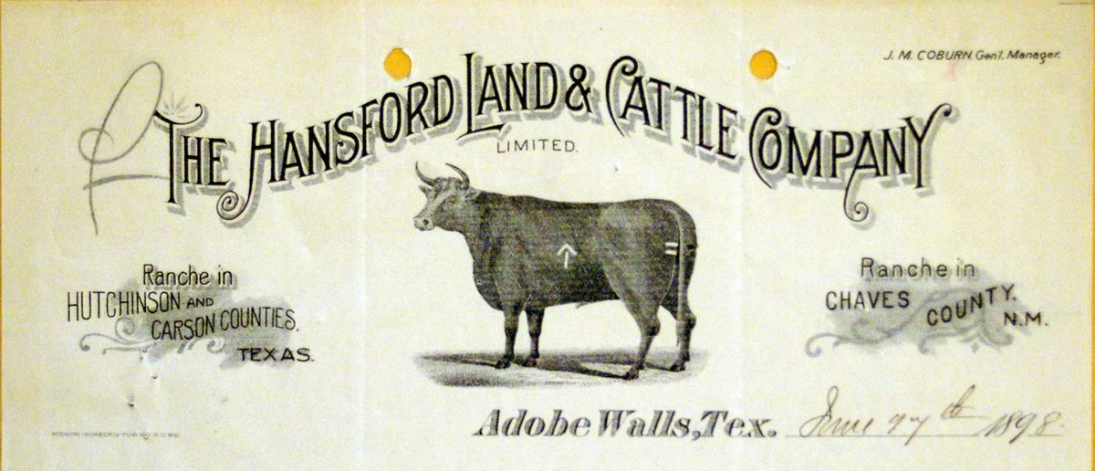
The Hansford Land & Cattle Company letterhead
Click
on image to enlarge
Engraving courtesy General Land Office |
|
History
in a Pecan Shell
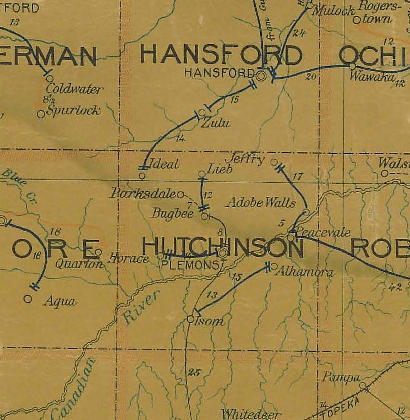
The name Adobe Walls has been applied to several trading posts north
of the Canadian
River.
Fort Adobe
The earliest date is given as 1843 and the first structure appeared
around 1845-46 when an 80 foot square adobe structure was built
and aptly called Fort Adobe.
Indian misbehavior forced the post to close by 1848. Attempts were
made to reestablish the post, but it was finally blown up in frustration,
providing the Panhandle with its first landmark ruins.
First Battle of Adobe Walls (See Markers)
In 1864 the First Battle of Adobe Walls was fought when Colonel
�Kit� Carson and his force of 335 men (with 75 Indian allies) fought
hostile Kiowas, with assorted Apaches, Comanches, and Arapahoes
near the ruins. The casualties were three dead with 15 wounded for
the Army and Indian casualties were estimated to be 60 killed or
wounded.
(See Kit
Carson at Adobe Walls by Clay Coppedge
The First Battle of Adobe Walls featured a man who was a legend
in his own time and who was actually deserving of that reputation...
more)
Second Battle of Adobe Walls (See Markers)
Ten years later, Dodge City, Kansas merchants opened a trading post/
restaurant/ saloon a mile from the original ruins. Trade with the
area�s buffalo hunters flourished until June 1874 when the Second
Battle of Adobe Walls took place. The main building was constructed
of sod - in the fashion of Kansas buildings - and although the complex
was overwhelmed by a force estimated between 300 to over a thousand
Indians, the defenders held their own with only three dead (one
an accident after the fight was over). The post was abandoned.
(See Veteran
Recounts Battle of Adobe Walls by Mike Cox
Fifty years earlier, surrounded by hundreds of hostile Indians,
Andrew Johnson and the other occupants of the Panhandle trading
post and buffalo hunter�s camp called Adobe Walls fought desperately
for their lives... more)
Later the Turkey Track Ranch made its headquarters near the
original site. Former Army scout and survivor of the 1874 fight,
Billy Dixon built a house
at the ruins of Fort Adobe. In 1887 Dixon�s house became
the community post office and Dixon became postmaster.
Adobe Walls as touted as an up and coming settlement in an attempt
to recruit settlers, but in truth it never truly developed. The
population never exceeded 20 throughout the 20th Century.
|
 |
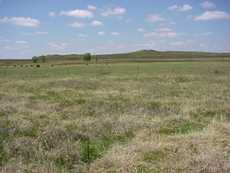
A Visit to
Adobe Walls
Photographer's
Note:
"All there is to be seen of Adobe Walls are Markers and Monuments.
Some are on the Stinnett-Spearman highway and the rest are at the
site. There are no structures or remains of any kind to be seen."
- Barclay
Gibson, January 28, 2009 |
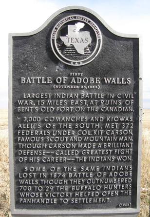
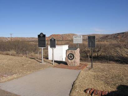
First
Battle Of Adobe Walls Site / Markers
|
Historical Marker:
First Battle
of Adobe Walls
Largest Indian
battle in Civil War. 15 miles east, at ruins of Bent's Old Fort, on
the Canadian.
3,000 Comanches and Kiowas, allies of the South, met 372 Federals
under Colonel Kit Carson, famous scout and mountain man. Though Carson
made a brilliant defense - called greatest fight of his career - the
Indian won.
Some of the same Indians lost in 1874 Battle of Adobe Walls, though
they outnumbered 700 to 29 the buffalo hunters whose victory helped
open the Panhandle
to settlement.
(1964) |
|
|
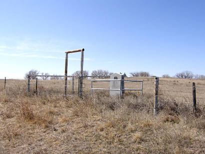
First
Battle Of Adobe Walls Site
Photo courtesy Erick Whetstone, 4-22-04 |
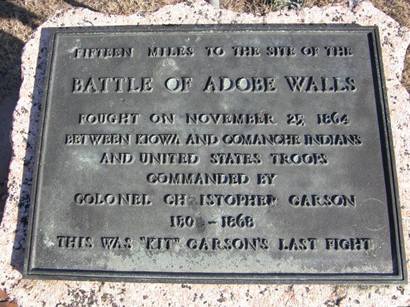
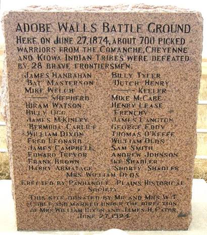
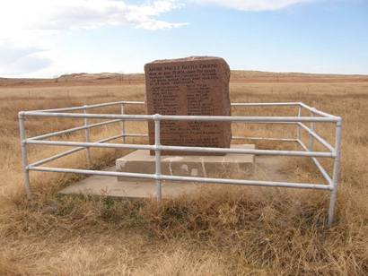
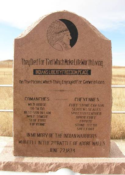
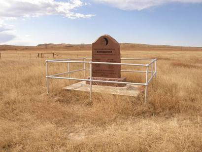
Second Battle
of Adobe Walls -
Battle Ground Marker
June 27, 1874
|
Marker
in Memory of The Indian Warriors
Who Fell in The Second Battle of Adobe Walls
June 27, 1874
|
Subject:
Battle of Adobe Walls
"The Indians did make a comment as they were leaving the scene
of Adobe Walls. I am surprised that it isn't noted (That I could
find.)
Maybe I know because I am part Caddo. but, when I visited the location
in 1966 with my dad, he told me this. Due to the distance from the
mounds that the bullet traveled and found it's high ground mark to
the North, that one Chief stated: "Shoot today, Kill tomorrow."
In 1966 when we visited, the mounds were only about 2 feet high, I
have not been back since. The walls were formed in a small square
as best that I could tell. The location on the North side of the Canadian
River was located near a bend in the river that turned in a southerly
direction. There were a few Cottonwood trees near the river and a
Texas plaque on a metal post stating the information about the 1874
battle." - Cal Hunt, February 03, 2011 |
Archeological
Site
The Panhandle-Plains Historical Society acquired six-acres of the
1874 site in 1923 and archeological digs have turned up a trove
of artifacts. The site is on the National Register and is Texas state
archeological landmark. |
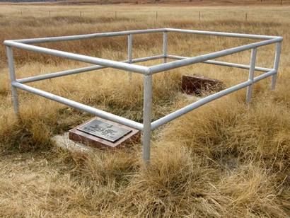
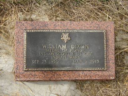
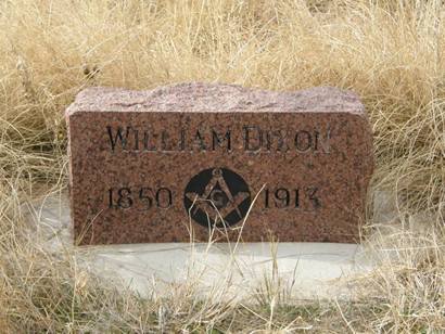
William
Dixon
Indian Scout 6 US Cavalry |
 |
 |
 |
|
From "Water
needed for towns" by Delbert Trew
History states on June 27, 1874, at daylight, a large force of Indians
under the command of Quanah
Parker attacked the Buffalo Hide hunting camp of Adobe Walls,
located northeast of Borger
just north of the Canadian
River.
Reams of information have been written about the famous battle,
recovered artifacts fill numerous displays in museums, and the battle
participants have been awarded honors and made famous for their
efforts during this famous episode in Panhandle history.
History also leaves the impression the site seemed to die after
the Indians returned and burned it to the ground. This is not true.
Adobe walls do not burn, only the wooden portions of the roof and
partitions inside were destroyed. In fact, according to Cleon Roberts,
historian and writer from Hereford, in his article published in
a book titled "The Encyclopedia of Buffalo Hunters and Skinners,"
Adobe Walls lived and thrived for about seven more years after the
Indians supposedly left it in ashes.
It seems a stockade (standing adobe walls) was used as a store run
by A.G. Springer in 1875, a year later. James H. Cator, a famous
buffalo hunter and resident living at the nearby Zulu Stockade,
visited the site many times for supplies.
With buffalo
hunters, ranchers, cowboys, mustang hunters and others visiting
for some seven years after the Indian battle, there is no doubt
Adobe Walls had an interesting and continuing history and afterlife.
� Delbert
Trew
|
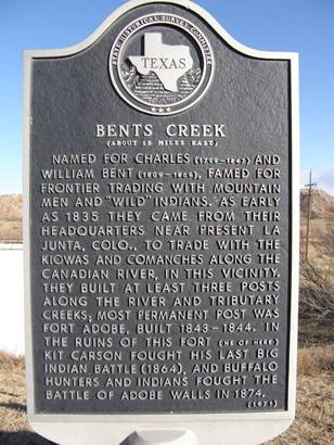 |
Bents Creek Historical
Marker
Photo courtesy Barclay
Gibson, December 2008 |
Related
Articles:
Bird's
Creek by Clay Coppedge
"Sometimes history remembers the marksman and other times it's
the victim whose name attaches itself to historical immortality.
The deciding factor is who writes the history, and the history of
the Old West was not written by the Indians.
That's why frontiersman Billy Dixon's famous rifle shot in 1874
at the Battle of Adobe Walls has become part of western history
and mythology. It's known as the shot of the century..." more
Veteran
Recounts Battle of Adobe Walls by Mike Cox
"Fifty years earlier, surrounded by hundreds of hostile Indians,
Andrew Johnson and the other occupants of the Panhandle trading
post and buffalo hunter�s camp called Adobe Walls fought desperately
for their lives..." more
Kit
Carson at Adobe Walls by Clay Coppedge
"The First Battle of Adobe Walls ... featured a man who was
a legend in his own time and who was actually deserving of that
reputation..." more
Billy
Dixon's Long Shot Analized by Mike Cox
|
 |
 |
| Texas
Escapes, in its purpose to preserve historic, endangered and vanishing
Texas, asks that anyone wishing to share their local history, stories,
landmarks and recent or vintage photos, please contact
us. |
|
|

 Texas
Gulf Coast
Texas
Gulf Coast East
Texas
East
Texas Central
Texas North
Central
Texas North Central
Texas South
Central
Texas South Texas
Panhandle
Texas
Panhandle South
Texas
South
Texas Texas
Hill Country
Texas
Hill Country West
Texas
West
Texas Texas
Ghost Towns
Texas
Ghost Towns Texas
Counties
Texas
Counties