|
|
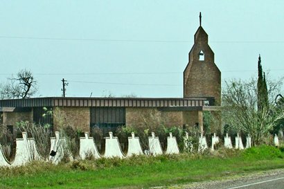
St. Mary Magdalene
Church in Abram
Photo courtesy Ken
Rudine, February 2008 |
History
in a Pecan Shell
The town was named for Texas Ranger Abram Dillard, who lived in the
vicinity of Ojo de Agua Creek. A ranch by the name Ojo de Agua
was established later and the community is sometimes called by this
name.
The Ojo de Agua - or watering hole was on the military supply route
from Fort Brown to Fort
Ringgold. A post office was granted in 1901 and the railroad laid
tracks a few miles North of the community three years later.
During one of the Mexican revolutions Abram was the site of a fight
between the U. S. Cavalry and bandits that had crossed the river.
The population of Abram at this time (1915) was a mere 50 people and
it never exceeded 100 people until the 1970s.
A colonia developed near enough to Abram to be included in the area's
1990 census. There is now a population of 5,444 population (2000 census)
living in the area.
Greater Abram receives its water from the La
Joya Water District. |
|
|
Photos
Courtesy Ben Cardenas |
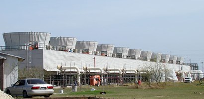
Power plant on
the Rio Grande
Photo courtesy Ken
Rudine, February 2008 |
Abram, Texas
Forum
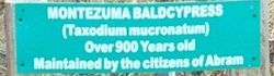
"... This
little village has a TREASURE to be shared. There is a 900+ year
old tree that stands hidden in the community! Actually, the tree
is classified as a "Montezuma Baldcypress," and a sign is posted
in front of the tree for authenticity...." - Ben Cardenas,
March 14, 2002
Our thanks to contributor Ben Cardenas for suggesting Abram
and it's record tree for inclusion in Texas Escapes.
See Texas Historic
Trees
|
| Texas
Escapes, in its purpose to preserve historic, endangered and vanishing
Texas, asks that anyone wishing to share their local history, stories,
landmarks and vintage/historic photos, please contact
us. |
|
|

 Texas
Gulf Coast
Texas
Gulf Coast East
Texas
East
Texas Central
Texas North
Central
Texas North Central
Texas South
Central
Texas South Texas
Panhandle
Texas
Panhandle South
Texas
South
Texas Texas
Hill Country
Texas
Hill Country West
Texas
West
Texas Texas
Ghost Towns
Texas
Ghost Towns Texas
Counties
Texas
Counties