|
|
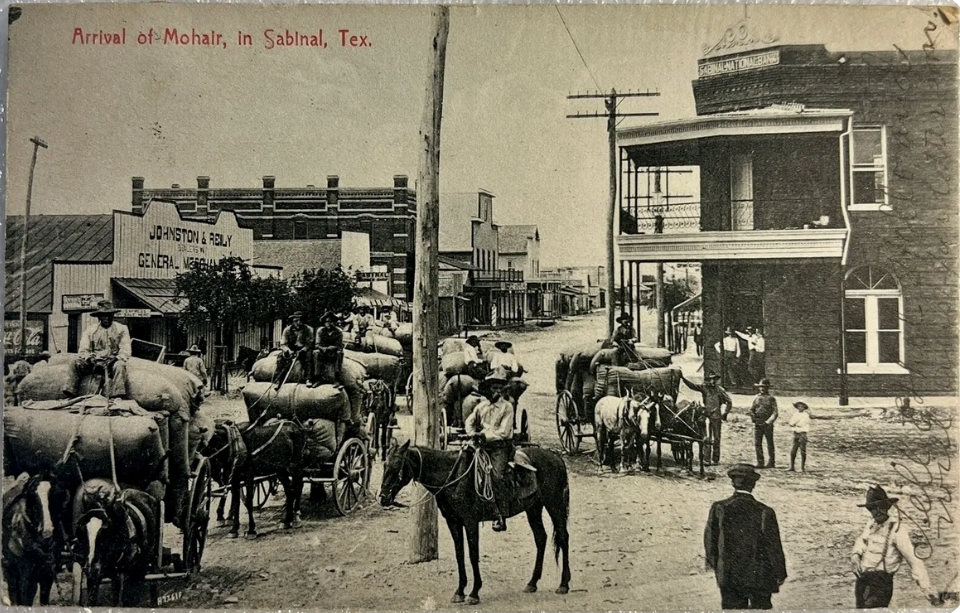
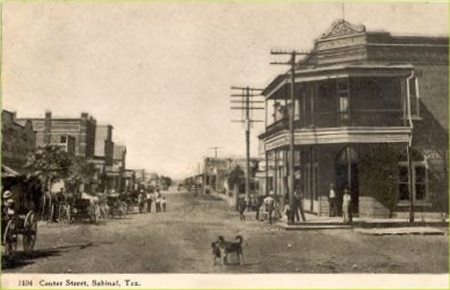
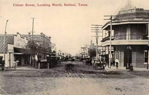
Arrival of
Mohair in Sabinal, showing Center Street with bank building and
Johnston & Reily General Merchandise, Postmarked
1909
Click on image to enlarge
Postcard
courtesy Dan
Whatley Collection
|
History in
a Pecan Shell
Thomas B. Hammer
is credited as being the first settler in the area. Hammer opened
a stage stop on the eastside of the Sabinal
River around 1854 and when a post office was granted the same
year the town was designated Hammer�s Station. A Cavalry outpost
was established in 1856 on the west bank of the river for the settlers
protection. The camp�s presence, however, didn�t intimidate the bandits
that killed Hammer in 1857.
Sabinal got a railroad (Southern Pacific) connection in 1881� the
same year that Turkish Angora goats were introduced. In 1893 the town
had two hotels and the population was reported as 150 for 1884 � not
bad for the era.
By 1906, the year the town incorporated, 500 Sabinalistas called the
place home. Irrigation for cotton crops was provided by the lumberyard�s
windmill and enough cotton was
produced to keep six gins in operation. Wool and mohair production
were important economic mainstays.
Water and fire departments were established and telephone service
began � all in the magic year of 1906. By 1911, the population had
swelled to an estimated 1,500 � and those who could read, read The
Sentinel - the town�s own weekly newspaper.
A school specifically for Hispanics was opened in the mid 1930s. With
schools consolidations, a new elementary and high school were built
in town. Five school buses fanned out daily to gather students over
the district�s 356 mile territory.
The population reached its zenith in the mid-1950s, with about 2,300
people, but it had declined to 1,570 by 1974 By 1990 the estimated
population was about the same. |
 |
|
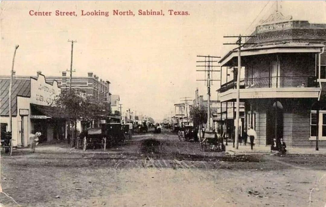
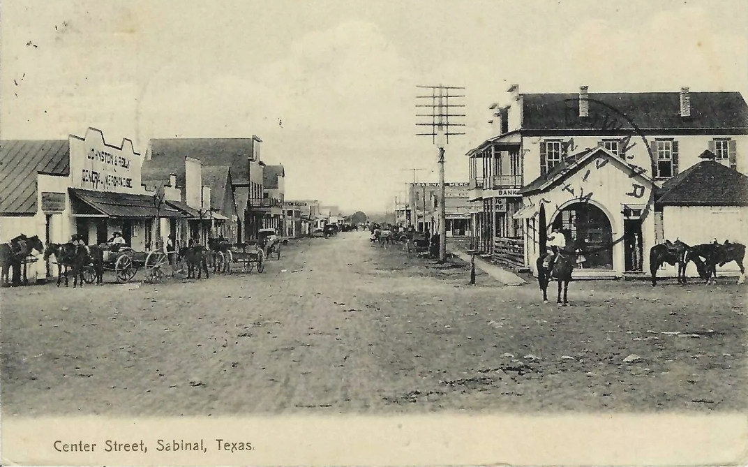
Center Street,
Looking North, showing bank building
Postmarked
1912
Click on image to enlarge
Postcard
courtesy Dan
Whatley Collection
|
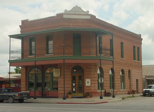
Bank Building
in Sabinal today
TE photo
4-04 |
Historical Marker:
(On US 90, 0.5 mile E of Hwy 127/FM 187
Sabinal
Named by Spanish
for Rio Sabina and Cypress trees along river. Town founded in 1854
by Thomas B. Hammer who operated a stage shop and was first postmaster.
Despite Indian depredations, town thrived as settlers built homes,
and a railroad reached here in 1881. In 1906, town was incorporated.
Telephone service started. City water works and volunteer fire department
organized. In 1907, Sabinal Christian College was founded. Closed
in 1917. Cotton industry was foremost in early 1900's. Today, farming
and ranching flourishing in community.
(1967) |
Sabinal, Texas
Landmarks
Photo Gallery |
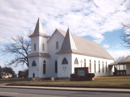
Historical Marker:
US 90, east city limits
Sabinal Methodist
Church
This church began
in 1876 as part of the Sabinal circuit assigned to the Rev. Henry
T. Hill. Circuit ministers served the fellowship until 1900, when
it became an organized congregation. Services were held in the Christian
and Baptist church buildings until the present structure was completed
in 1907. For a time pastors at Sabinal Methodist Church also served
new rural congregations in Trio and Knippa.
As the membership grew and church programs expanded to meet the needs
of the community, additions were made to the church facility.
1983 |
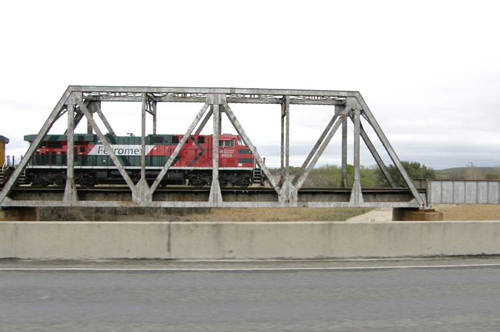
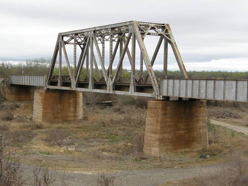
Railroad Bridge
West of Sabinal Texas
Photo
courtesy Barclay
Gibson, March 2008 |
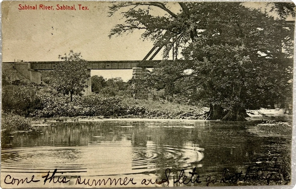
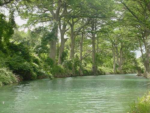
Sabinal River
The Sabinal River
which flows from springs north of Vanderpool
(Bandera County)
continues past Sabinal to the west of town and eventually joins the
Frio River.
The Sabinal River is only 60 miles long, and for some of its length
it flows underground. The Spanish had originally named the river Arroyo
de la Soledad, or "Stream of Solitude" |
"Arroyo
de la Soledad� - AKA Sabinal River
TE photo
4-04
More Texas Rivers |
|
Center Street,
Sabinal
Postmarked
1914
Postcard
courtesy www.rootsweb.com/ %7Etxpstcrd/
|
Sabinal,
Texas Forum
"I just
love to read Texas Escapes and think about vanished Texas of my
childhood. Today I read about Papalote
in Bee County. My
Bonham grandparents had a farm there. Wolves would get the livestock.
My grandfather said Papalote meant windmill.
My grandfather had several farms. The nicest was Sabinal, the beautiful
stone house where VP John Nance Garner's wife, Ettie grew up. I
lived there too when I was early teenage and the house is magic.
Has an historical marker now. We would go to Garner
State Park and I still remember how sweet and pure was the air.
How fresh and crisp. I could smell the trees." - Barbara
Duvall Wesolek, July 30, 2020
|
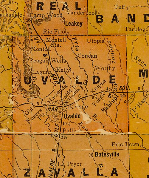
Uvalde
County 1920s map showing Sabinal, Sabinal Creek, Frio Rio
East of Uvalde the county seat
From Texas state map #10749
Courtesy
Texas General Land Office |
| Texas
Escapes, in its purpose to preserve historic, endangered and vanishing
Texas, asks that anyone wishing to share their local history, stories,
landmarks and recent or vintage photos, please contact
us. |
|
|