|
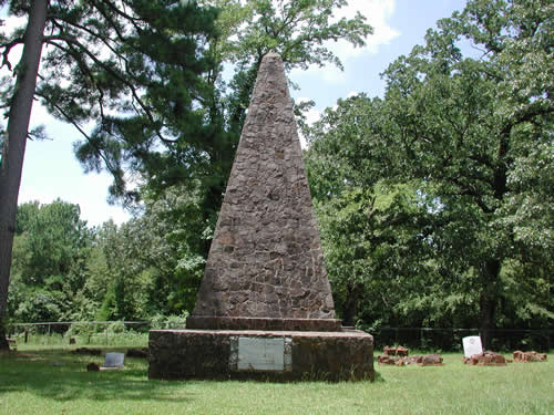
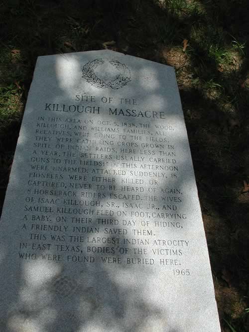
The native stone
monument to the Killough
Massacre
CR-3431, Larissa, TX
Photo courtesy Janet Gregg, 2005 |
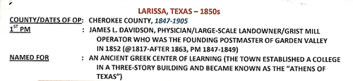
History in
a Pecan Shell
The area was first
settled by Isaac Killough, and his extended family in 1837. After
briefly vacating the area for the safety of Nacogdoches,
the Killough group returned to harvest their corn crop. The Indians
assured the group they would not be molested - but angry because of
a broken treaty - the Indians did attack - resulting in what is believed
to be the worst Indian attack in Texas history - the Killough
Massacre.
Resettlement of the area had to wait until after Texas statehood.
In 1846, a group of Tennesseeans arrived under the leadership of a
man named Thomas H. McKee. The settlement was known at first as the
McKee Colony.
Thomas' son T. N. McKee, platted a townsite naming it after an ancient
Greek city famous for education. McKee, who became a Presbyterian
minister, insisted on distancing his town from nearby Talladega -
since that town had a saloon.
According to legend, in 1848 the Thomas McKee sold a slave in Shreveport
and then used the proceeds to buy the town a one-room schoolhouse.
In 1855 the school was acquired by the Brazos Synod of the Cumberland
Presbyterian Church and became Larissa
College. The post office was granted in 1847 and a Masonic lodge
opened two years later.
During the early 1850s Talladega started to disappear, its businesses
lured to Larissa.
By the mid 1850s, Larissa had a three-story college building, and
two large dormitories. In 1866 the Presbyterians stopped supporting
the college and it closed its doors in 1870. The town had prospered
based on the school's enrollment so when the school closed Larissians
started looking for greener pastures.
A meningitis epidemic in 1872 depleted the population further and
when things didn't look like they could possibly get worse, the town
was bypassed by an arriving railroad (the Kansas and Gulf Short Line
Railroad) in 1882. The few remaining families moved to Mount
Selman to have a railroad connection.
In the 1880s Black families moved into the abandoned houses and started
farming. The post office managed to remain open until 1905 when mail
was rerouted through Mount
Selman.
During the time the Great Depression arrived, Larissa had a church,
a school, a store, and more than a few houses. The residents continued
moving for better jobs and by the early 1990s only a few scattered
houses and a lodge hall remained at the site. |
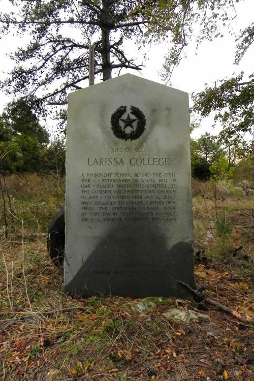 |
Site
of Old Larissa College Centennial Marker
Photo courtesy Barclay
Gibson, November 2010 |
Larissa
College Centennial Marker
Photo courtesy Barclay
Gibson, November 2010 |
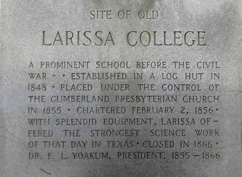
Texas
Centennial Marker:
Site of Old
Larissa College
A prominent school
before the Civil War.
Established in a log hut in 1848. Placed under the control of the
Cumberland Presbyterian Church in 1855. Chartered February 2, 1856.
With splendid equipment, Larissa offered the strongest science work
of the day in Texas.
Closed in 1866.
Dr. F. L. Yoakum, President, 1855-1866.
1936 |
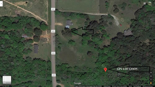
Photographer's
Note:
Larissa College Centennial Marker location:
"Your GPS is almost the exact location of the marker itself which
is just to the northwest under the trees. At the time it was behind
an old trailer house." |
Larissa
College Marker Location
Photo courtesy Barclay
Gibson, November 2010 |
Site of The
Killough Massacre historical marker
Photo courtesy Janet Gregg, 2005 |
The Killough
Massacre
The Killough Massacre,
October 5, 1838
Story & photos by Janet Gregg
A Monument to the Killough
Massacre
by Mitchel Whitington
from "Ghosts of East Texas and the Pineywoods"
"Killough Monument is not the most intuitively obvious place
to find, and in fact, I had to make a couple of trips there before
I ran across it myself. Here are the directions to make it a little
easier on you:
- From the
intersection of Highway 69 & Farm/Market (FM) Road 855 go west
on FM 855 until you reach FM 3405. There is a sign there (or was
at one time) that reads �Killough Monument� and points to the
left.
- Turn left
on FM 3405 and go just about .4 miles to FM 3411.
- Turn right
on FM 3411 and go .6 miles until you reach a road with a green
gate with a huge boulder on either side. That is actually FM 3431,
but there is no sign there.
- Turn left
and proceed through the gate � the monument and cemetery are at
the end of the road."
[more] |
 |
 |
| Texas
Escapes, in its purpose to preserve historic, endangered and vanishing
Texas, asks that anyone wishing to share their local history, stories,
landmarks and recent or vintage photos, please contact
us. |
|
|

 Texas
Gulf Coast
Texas
Gulf Coast East
Texas
East
Texas Central
Texas North
Central
Texas North Central
Texas South
Central
Texas South Texas
Panhandle
Texas
Panhandle South
Texas
South
Texas Texas
Hill Country
Texas
Hill Country West
Texas
West
Texas Texas
Ghost Towns
Texas
Ghost Towns Texas
Counties
Texas
Counties