|
PAMPA, TEXAS
Gray
County Seat, Texas
Panhandle
35�32'35"N 100�57'53"W (35.543005, -100.964744)
US 60, Hwy 70, 152, 273
24 miles N of I-40 (Old Route 66)
29 miles SE of Borger
40 miles SW of Miami
46 miles SW of Canadian
62 miles S of Perryton
54 miles NE of Amarillo
ZIP codes 79065-79066
Area code 806
Population: 17,068 Est. (2019)
17,994 (2010) 17,887 (2000) 19,959 (1990)
Book Hotel Here › Pampa
Hotels |
 |
Pampa
was named by the manager of the White Deer Land Company. According
to sources - he had visited Argentina and the grassly landscape of
the Panhandle reminded
him of the Argentine Pampas.
History in a Pecan Shell
1887: city started by being designated a stop on the Southern Kansas
Railway known as Glasgow
1892: post office granted
1902: townsite was platted and Gray
County was organized
1910: population reaches 400
1912: Pampa incorporates
1926: oil discovered
1928: Pampa becomes county seat over Lefors
1931: population over 10,000
1932: Fort Worth and Denver Railroad lays tracks through Pampa
1935: April 14, 1935 - Famous Dust
Storm of "Black Sunday"
1942: Pampa Army Air Field opens
east of town
1945: Pampa Army Air Field closes east of town |
Historical Marker:
1 Albert Square, Pampa (faces Courthouse Square on Kingsmill).
Pampa
In 1888 a telegraph station on the Southern Kansas Railroad developed
here, and was named Glasgow. Renamed Sutton a year later,
a post office was established in 1892 and the town was named Pampa
by George Tyng (d. 1906), manager of the White Deer Land Company.
Surveyor A. H. Doucette (1884-1964) laid out the town in 1902. The
first school opened in 1903 and the first church was organized in
1906. J. N. Duncan (1858-1941) became Pampa's first mayor in 1912.
Following a 1920s oil boom, the county seat was moved here from Lefors
in 1928.
1986 |
Pampa, Texas
Landmarks / Attractions:
|
The Pampa
City Hall, 1930
Recorded Texas Historic Landmark
200 W. Foster Avenue
Photo
courtesy Terry
Jeanson, September 2007
|
Historical Marker:
200 W. Foster Avenue
Pampa City
Hall
Construction of
this and other major downtown buildings in Pampa came as a result
of the Texas Panhandle Oil Boom of the late 1920s and early 1930s.
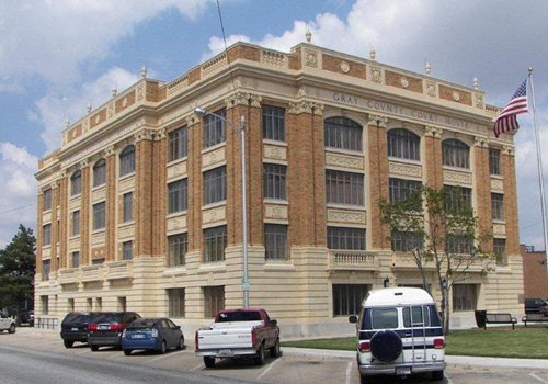
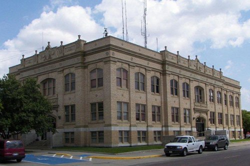
Designed by architect William R. Kaufman to complement the Gray
County Courthouse, which he also designed, the City Hall was completed
in December 1930. The beaux arts style building features triumphal
arch entrances with classical detailing and pilaster elements around
the perimeter.
Recorded Texas Historic Landmark - 1987 |
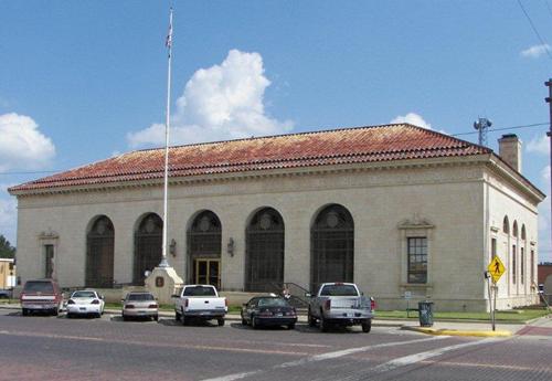 |
Historical Marker:
120 E. Foster
1934 Pampa
Post Office Building
A post office was
established here in 1892, and in 1902 the town of Pampa was formally
platted. Following the discovery of oil in the area in 1926 Pampa
experienced a population boom which created a need for a larger post
office. Built in 1933-34 by the Works Progress Administration, this
structure exhibits Spanish Renaissance Revival architectural influences
in its elongated rounded windows, tile roof, arcaded loggia, and decorative
modillions and stone work.
Recorded Texas Historic Landmark - 1992 |
Historical Marker:
201 East Foster Ave
First Methodist Church of Pampa
Five charter members established the First Methodist Church in 1906,
the first denomination organized in Pampa. In 1908 a one-room white
church with a steeple was built. This church site was purchased in
1924, and a new sanctuary was completed in 1928. Additional buildings
and land were acquired as the congregation grew and renovations to
the structures were made. The church provides many educational and
worship activities for its members and supports the community with
several outreach programs. The First Methodist Church has served the
area for more than 90 years.
(1996) |
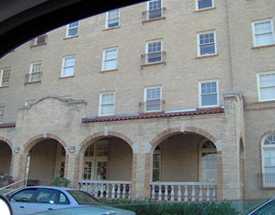
The former Schneider
Hotel is now in use as a retirement hotel. On the National Register
of Historic Places.
Photo
courtesy Sharon Thomas, July 2006
More Rooms
with a Past |
Historical
Marker: Beginning in Pampa, take SH 152 about 11 miles east to
intersection of SH 152 and FM 1474. (marker is on SE corner). The
marker is for the site of the former Pampa Army Air Field.
Site of Pampa
Army Air Force Base
In the early 1940s
Pampa Mayor Fred Thompson and a delegation from the city's Chamber
of Commerce traveled to Washington, D.C. to promote this area as a
possible site for a military base. Attracted by the terrain, climactic
history, available land and community response, Army officials chose
this site for the establishment of an installation to train pilots
and support personnel for World
War II.
Construction of the Pampa Army Air Force Base began in June 1942,
under the direction of the Tulsa, Oklahoma office of the Corps of
Engineers. Overseeing the initial stages of the operation was Col.
Norman B. Olsen. Temporary offices were set up in the Rose Motor Company
and Culberson-Smalling buildings in town. Col. Daniel S. Campbell
became the commanding officer in September 1942, and within two months
the first planes and aviation cadets had arrived.
The Pampa Army Air Force Base closed September 30, 1945, after just
three years of operation. During that time 6,292 aviation cadets and
3,500 mechanics were trained. The base's safety record was one of
the best in the U.S. Training Command during World
War II. Despite a brief history, the base had a dramatic impact
on the development of the Pampa area.
(1982) |
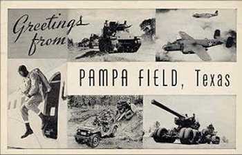 |
Pamper Field,
Texas
Postcard courtesy rootsweb.com/%7Etxpstcrd/ |
People
Indian
Jim by Mike Cox ("Texas Tales" Column)
Barely 50 years after the U.S. Cavalry drove the last hostile Indians
out of the Panhandle an Indian from New York made page-one news
in Pampa and across the nation.
Woody
Guthrie and the End of the World by Clay Coppedge
"The end of the world, as Guthrie perceived it that day [April
14, 1935] , came in the form of one of the worst dust storms in
American history. The storm had its origins in the Dakotas where
a high-pressure system was challenged by a hard-charging cold front
from Yukon country. The wind howled like a hammer and picked up
tons of Dakota dirt and propelled it southward, where many more
tons of dirt, exposed by the plow to the wind, was carried south,
toward Oklahoma and Texas."... more
|
Historical Marker:
320 S. Cuyler St.
Woody Guthrie
American folk musician Woodrow Wilson "Woody" Guthrie (1912-1967)
moved to Pampa from his native Oklahoma at age 17. Here he learned
to play the guitar and joined with other musicians to perform for
area events. Guthrie briefly attended Pampa High School and, from
1930 until 1935, worked as a soda jerk at this site, home of the former
Harris Drug Store. He also spent much time reading books in the Pampa
city library, preparing him for his most productive years as a poet-lyricist
and folk balladeer during the 1940s and early 1950s. He left Pampa
for California in 1937 and in 1940 went to New York City, where he
was recognized for his writings and performances. He died there in
1967.
(2002) |
1936 Centennial
Marker: Located just east of Highway 70 at turn off to Lake McClellan,
but before entering park, about 17 miles south of Pampa.
Indian Battlefield
In this vicinity Lieutenant Frank D. Baldwin, commanding two companies
of United States troops, attacked a large band of Indians and rescued
two white girl captives, November 8, 1874. |
Historical Marker:
Highway 70, 6 miles S of Pampa.
Red River Expedition of 1852
Randolph B. Marcy, U.S. Fifth Infantry Captain, and George B. McClellan
led a company into the Texas
panhandle in 1852 to determine the locations of the headwaters
of the Red River. That summer the team discovered two main branches
of the Upper Red River that intersect the 100th Meridan. The North
Branch is southeast of Pampa. Earlier treaties used the Red River
as a boundary, but it was unclear which fork was meant when first
defined. In 1896, the South Branch was determined to be the main stream
and the boundary between Texas and Oklahoma.
(1984, 1996) |
Pampa Area Lakes
Greenbelt Reservoir
McClellan Reservoir
Meredith Reservoir
Pampa
Hotels
|
| Texas
Escapes, in its purpose to preserve historic, endangered and vanishing
Texas, asks that anyone wishing to share their local history, stories,
landmarks and recent or vintage photos, please contact
us. |
|
|