|
|
While
environmentalists and water developers duel over the merits of preserving
the Neches River, the debate has largely overlooked the river�s history.
Sometimes called East Texas�
last wild river, the Neches has been flowing though eastern Texas
longer than any of the remnants of mankind, even the earliest Indians.
|
|
|
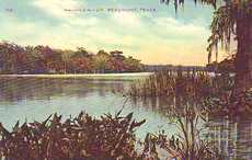
The
Neches River in Beaumont
Postcard courtesy Cruse Aviation |
Rising near Colfax
in eastern Van Zandt
County and winding 416 circuitous miles to the mouth of Sabine
Lake on the Gulf Coast,
the river and its basin was the home of the 12,000-year-old Clovis
culture.
Indian culture reached its peak with the arrival of the Caddos about
780 A.D.
The Caddos developed Mound Prairie in Cherokee
County, the southwesternmost example of the Mississippian mound-building
culture. Artifacts from this era can be seen at the Caddoan
Mounds State Historic Site, a few miles west of Alto.
When the first Europeans came to East
Texas in the sixteenth century, they found various tribes of Hasinai
Indians of the Caddo confederacy living along the stream, which they
called the Snow River--presumably for its white sand bars.
The river was supposedly given its currebt name by Spanish explorer
Alonso De Leon, who named it for the Neches Indians, one of the Caddoan
tribes he encountered.
On a later mission, De Leon was accompanied by Fray Damian Massanet,
who founded San
Francisco de los Tejas, the first Spanish mission in East
Texas, near present-day Weches in Houston
County.
Despite the efforts of the Spanish to colonize the river basin, white
settlers did not enter the region until the l820s, When Mexican official
General de Mier y Teran was sent to the region in 1828, he found numerous
Anglo-American settlers, who used hand-driven ferries to cross the
Neches and open the region to settlement.
General Teran built a fort on a bluff of the Neches near present-day
Rockland in Tyler County
to serve as a Mexican outpost in the region. The Mexicans supposedly
operated a lead mine on the bluff until the fort was abandoned. The
exact site of the fort remains unclear.
On his first trip to Texas, Stephen
F. Austin wrote in 1821 that the Neches �affords tolerable keel
boat navigation.� Barges were used to float cotton and other farm
produce to Sabine Bay in the l830s and 1840s and steamboats began
to travel up and down the waterway in the late l840s. Some of the
earliest steamers include the Angelina, Florida, Frankie, Katy,
Laura, Neches Belle, Pearl River and Star.
Scattered up and down the length of the river are remnants of history,
including old river ports, logging
camps, sawmill ghost
towns, ferries, and Republic of Texas landmarks. |
|
|
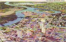
Aerial
view of the Neches River and downtown Beaumont
Postcard courtesy Cruse Aviation |
One of the basin�s
most significant historical sites is old Bevilport, which lies
north of Steinhagen Reservoir. The town, only a shell of its former
self, was the seat of government for the Bevil District and the county
seat of Jasper County.
The two also had some ties with Sam
Houston. The general was given the town�s first lot when it was
incorporated by the Republic
of Texas in 1837.
An entry in an old store ledger also shows the hero of San
Jacinto also bought a gallon of kerosene on credit there in the
l830s -- and never paid for it.
All
Things Historical September 28, 2005 Column
Published with permission |
| Texas
Escapes, in its purpose to preserve historic, endangered and vanishing
Texas, asks that anyone wishing to share their local history, stories,
landmarks and vintage/historic photos, please contact
us. |
|
|