|
Remembering
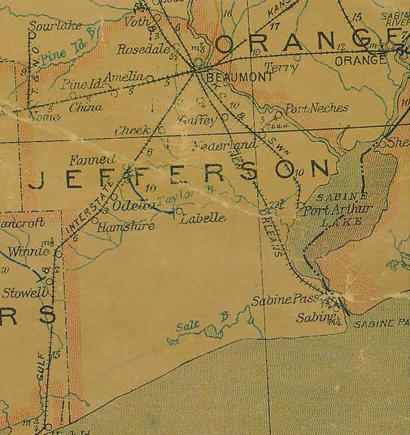
Sabine Pass
by Stan Weeber,
Ph.D. |
Even
if people forget that Hurricane Rita made landfall near Sabine
Pass, Texas in September of 2005 � and they probably will � history
still provides much to remember about this small town that is the
southeastern most place in the state of Texas.
Historical markers in the town note that the first settlers in the
area arrived in 1832. The next year, Sam
Houston assisted Nachogdoches politician Manuel de los Santos
Coy in acquiring a land grant. On January 19, 1839, General Houston
signed the charter that established the city
of Sabine. Houston was active in promoting the sale of 2,060 town
lots, and the city soon flourished, developing into a major port.
In 1860 the State Legislature approved a new charter for the city
and changed its name to Sabine
Pass.
The town was the scene of a memorable major Civil War engagement,
the Battle
of Sabine Pass, in September, 1863 with Confederate forces preventing
a Union attempt to capture the port and gain major inroads into Texas.
It was one of the most lopsided victories in naval history. Fewer
than 50 Confederate troops led by Lieutenant Richard
W. Dowling repulsed a fleet seeking to land up to 15,000 Federal
soldiers. Dowling�s company, mostly Irishmen from Galveston
and Houston, had been
comrades in arms since February 1861. Sabine
Pass was a strategic center for blockade-running whereby the Confederacy
exported cotton and obtained in exchange vital goods such as medicines
and arms. Here Dowling�s company built Fort Griffin, named in honor
of Lieutenant Colonel W. H. Griffin, the Confederate commander at
Sabine City.
The fort was earthwork strengthened with railroad iron and ship's
timbers, and amazingly it was unfinished when the Confederates learned
of the approach of 22 ships. Dowling kept watch, but ordered no response
to the early shelling by the Federals. When the first ships entered
range of Fort Griffin's guns, however, the battle began. Dowling himself
served as one of the gunners. The fort sent 137 shells toward the
targets.
Several books and research monographs have been written about what
transpired during the battle, each highlighting different aspects
although converging on certain themes. One is that the Irish Confederates
were skillful fighters, taking advantage of their knowledge of the
tricky terrain in Sabine Pass.
A second theme was the blundering of the Union troops, who needed
to station only one ship north of the fort to begin a broadside assault
that would have most likely ended in a Union victory.
The following basic facts of the battle are noted in the town�s historical
markers: Dowling and his troops held off the Union gunboats advancing
up the pass. The U.S.S. Clifton and the U.S.S. Arizona ran aground
early in the battle. The Clifton and the U.S.S. Sachem both surrendered
when disabled by cannon fire. After the battle, more than 300 Federal
troops became prisoners of war. Others were killed or missing; many
of those had been aboard the Sachem when its boiler exploded as a
result of a direct hit on the ship.
After
the war the town grew as the Federal Harbor Act of 1882 led to construction
of jetties and the development of inland ports along the Neches and
Sabine rivers. In October 1886, Sabine
Pass was the second largest town in Jefferson
County, boasting a new rail line and an optimistic outlook on
continued growth as a major coastal port.
On the afternoon of October 12 that year, just two months after a
hurricane had destroyed the Texas port of Indianola,
a fierce storm ravaged the town of Sabine
Pass. The hurricane's 100 mile-per-hour winds and the swiftly
rising water swept homes off their foundations and carried people
and animals as far as 25 miles away. Eighty-six people, including
entire families, were killed, and only two of 77 houses remained intact
after the waters subsided. Stories of survival have been documented
by historians, signifying the determination of residents to endure
the storm. Rescue and cleanup efforts began promptly, with the citizens
of Beaumont, Orange,
Galveston and Houston
providing boats, rescue teams and financial assistance. Special legislative
action provided tax relief for the storm-ravaged area, exempting citizens
from payment of state and county taxes in 1886. As one of several
difficulties Sabine Pass faced
in the late 19th and early 20th centuries, the 1886 hurricane contributed
significantly to the town's decline in the years to come as railway
maintenance proved difficult.
The
strategic Sabine Pass emerged
once again as an important defense base during the Spanish-American
War. As tension mounted between the United States and Spain during
the late 1890s, U. S. Representative Samuel Bronson Cooper of Texas
recommended the War Department begin plans for the defense of the
Pass. Major James B. Quinn of the Army Corps of Engineers in New Orleans
was authorized to direct construction of two forts on land granted
by Augustus F. Kountze. Work on the batteries was under way by May
1898, one month after the formal war declaration. Military efforts
were coordinated with area residents by government engineer J. L.
Brownlee. Although the emplacements were soon completed, the shore
guns were never part of military action at the Pass.
The natural topography of Sabine
Pass became one of the primary points of defense along the Gulf
Coast during World
War II. In 1941, the U.S. Navy established a Harbor Entrance Control
Post (HECP) at the Pass to provide defenses against potential enemy
activity in the area. Soon after, the U.S. Army installed artillery
emplacements at Texas Point, about 3 and one half miles to the south,
that included two 155mm Howitzer guns on Panama mounts, as well as
four munitions magazines at this site. The Army's lease of land at
Sabine Pass resulted in the location of a temporary harbor defense
unit manned by the 256th Coastal Artillery Regiment at Texas Point.
Other elements of the defense system included two base end stations,
an observation tower, signal stations, large coastal searchlights,
a battery commander post and part of the Coast Guard lifeboat station.
The munitions magazines also held other ordnance for area installations.
Working together, the HECP and the Army post utilized these storage
magazines to service the war effort.
Sabine
Pass has suffered an unfortunate string of experiences with hurricanes
that made landfall in or nearby the town. In addition to the hurricane
of 1866 that greatly affected the town�s growth as a rail center,
storms blew through in 1900, 1915, 1957, and 2005. Audrey, which hit
nearby Cameron, Louisiana in 1957, was the final straw in breaking
Sabine Pass� quest for economic
development. As a result of Audrey, development moved north to the
cities of Beaumont, Port
Arthur, and Orange, which still
dominate the area�s economy today.
Sabine Pass� colorful history
continued in 1959 when a native son and musician, J.P.
�Big Bopper� Richardson died in an Iowa plane crash which became
the story line for Don McLean�s 1971 classic song, American Pie.
The
last of the hurricanes to hit was Hurricane Rita in 2005. Rita appeared
early on to be a Category 5 monster that could totally and perhaps
permanently erase the city of Sabine
Pass. Fortunately for the people of the town, the hurricane weakened
to Category 3 before hitting them head on. Still, ninety percent of
the buildings in the town experienced some kind of damage.
My own field trip to this remarkable place was in early June, 2006,
over seven months after Rita struck. I was interested in finding out
if this history-rich place would be able to rise yet again from the
ravages of a horrific and devastating storm.
Entering
from the north on Texas 87, the scene was grim. Businesses on both
sides of the road were completely destroyed and appeared to me as
if the storm had just passed.
At the center of town at the intersection of highways 87 and 3322,
there were signs of life. Someone had purchased a soft drink machine
and placed it on his porch, and the place appeared to be an impromptu
community center after the storm. A restaurant nearby had reopened.
Across the street, the softball field was repaired and a crowd gathered
to see a game. Further west on 87, repairs to gravesites were underway
at the Confederate cemetery. Further down the road on 87, some new
dwellings stood out among the others that were in various stages of
repair. Sea Rim State Park was closed, a reminder of the ferocity
of Rita�s winds. At the McFaddin National Wildlife Refuge,
the occasional remnants of boats that washed ashore were the only
remaining signs of the hurricane.
Turning around and heading east back into town, I returned to the
major intersection. Heading right on to 3322, I went south to the
historical park near Fort Griffin. The park was closed but that did
not stop me from jumping over the orange fences, taking in the scene,
and imagining how the Battle
of Sabine Pass might have played out in real time. Much of the
information about the town and the battle that was shared earlier
was obtained from historical markers within the park. It appeared
to me that the Pass was now wider and deeper than it had been in 1863,
judging from the drawings in the historical monographs that I consulted.
This means that the Battle, had it been fought today, might have had
a much different outcome.
Going north back into town, I turned right at the main intersection
on to Broadway. Ahead was the most impressive part of the Sabine
Pass skyline, the offshore oil rig that was being built in the
waters of the Pass just east of town. On the way out to look at it,
the neighborhood looked much like the one on 87 headed west toward
Galveston: some
buildings totally repaired, others in various states of repair.
I am completely confident that the town of Sabine
Pass will come back. It is a resilient place, having come back
from four previous hurricanes. Rita is just another storm for the
hearty souls here to conquer. There is much here worth remembering,
not just about Rita but about the area�s rich past. I can only hope
that future historians will tell fewer stories of conflicts with people
and with nature, and more about the remarkable spirit of resiliency
and triumph in this tiny place, and how it thrived despite the long
odds against it.
© Stan Weeber
Associate Professor, Sociology
McNeese State U. |
 |
|
|


