|
Texas
| Counties
FISHER COUNTY,
TEXAS
32� 44' 24"
N, 100� 24' 0" W (32.74, -100.4)
Population: 3,974 (2010)
Total area: 902 square miles (2,340 km2)
899 square miles (2,330 km2) land
2.8 square miles (7.3 km2) water |
Fisher County
History
(from 1936
Texas Centennial Marker)
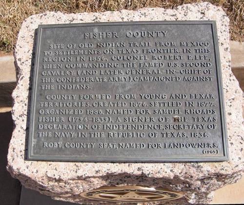
FISHER COUNTY
Sites of old Indian trail from Mexico to settlements on Texas frontier.
In this region in 1856, Colonel Robert E. Lee, then commanding the
famed U.S. Second Cavalry (and later General-in-Chief of the Confederate
Army), campaigned against the Indians.
County formed from Young and Bexar territories.
Created 1876.
Settled in 1877.
Organized 1886.
Named for Samuel Rhoads Fisher (1794-1839), a signer of the Texas
Declaration of Independence, Secretary of the Navy in the Republic
of Texas, 1836.
Roby, county seat, named
for landowners. |
Fisher County
Town List
Cities, Towns &
Ghost Towns: History, attractions, landmarks, architecture, monuments,
museums, cemeteries, bridges, parks, vintage & contemporary images,
area destinations, hotels,
and forum.
County Seat - Roby
Book area Hotels - Sweetwater
Hotels |
Fisher County,
Texas Vintage Maps
|
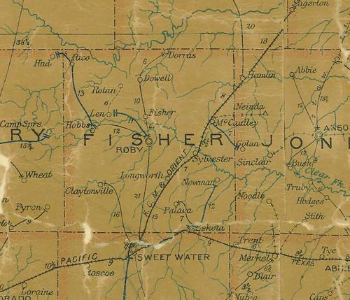
Fisher County
1907 postal map
From Texas state map #2090
Courtesy
Texas General Land Office |
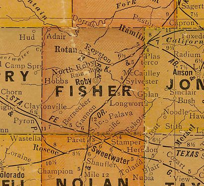
Fisher County
1920s map
From Texas state map #10749
Courtesy
Texas General Land Office |
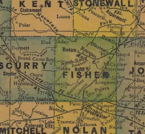
Fisher County
1940s map
From Texas state map #4335
Courtesy
Texas General Land Office |
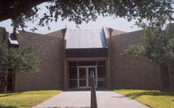
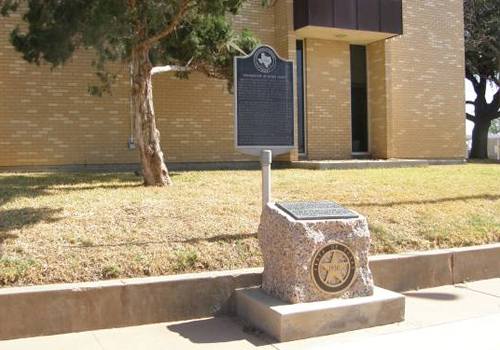
Fisher County
1936 Texas Centennial Marker
Located
in SW corner of courthouse lawn in Roby |
Fisher
County TX 1936 Centennial Marker
Photo courtesy Barclay
Gibson, April 2009 |
|
|