|
|
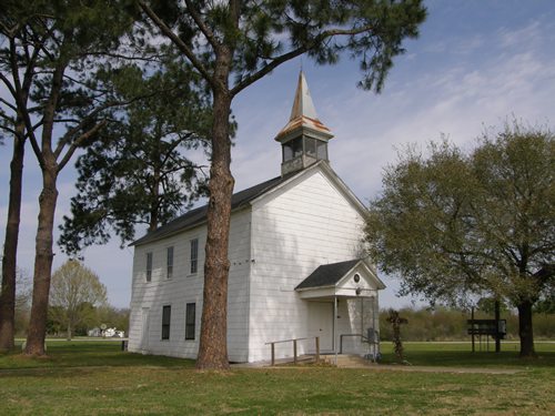
San Felipe Methodist
Church
Recorded Texas Historic Landmark
TE photo,
March 2008
More Texas Churches |
History on
a Pecan Shell
The "unofficial" capital of Stephen
Austin�s colony in 1824, the site was chosen for an existing ferry
crossing of the Brazos River, fresh water (from wells) and the tall
river bluff which offered a defense, should one be needed.
The name was suggested by the Mexican governor, after his patron saint.
By 1828 the town was thriving with two hundred people and a grid of
streets, including four public plazas.
Austin lived here for four years, tending to the business of his colony.
In 1828 he turned over most day-to-day responsibilities of running
the town to others.
The town became a postal hub for outlying communities and was home
to two newspapers � one of which (the Telegraph and Texas Register)
was published by Gail
Borden, surveyor, and (in later life) the inventor of condensed
milk. (See Borden,
Texas)
The town was a virtual Who�s Who of early movers and shakers. A grist
mill was in operation by 1830, followed by a lumber mill which supplied
the planks for housing, furniture and wagons. Keel boats connected
the colony to gulf ports and cotton
farming was established. Cattle
were driven to Nacogdoches.
Prior to the Revolution, San Felipe was second only to San
Antonio as a commercial center. Just before hostilities, it had
a population nearing 600.
After the fall of the
Alamo, Houston�s army retreated through San Felipe. On March 30,
1836, the town was set afire to prevent it from aiding the approaching
enemy.
Weeks later, after the defeat of Santa Anna, residents returned to
find cabins, stores and warehouses burned to the ground. While some
rebuilt, the missing infrastructure prevented the town from assuming
his previous role.
Instead of a capital (unofficial or not) it settled on being the county
seat of the freshly minted Austin
County. That changed in 1846 when an election was held and Bellville
was made county seat. Total transference was completed in 1848.
In the mid-1870s San Felipe unwisely declined to let the Gulf,
Colorado and Santa Fe Railroad pass through their town. A few
years later the railroad bought a right-of-way through Sealy,
giving that town a shot in the arm even while it drained population
from San Felipe.
The Texas Western Narrow Gauge Railway built through the area
in 1882. Now well-aware of the importance of the railroad,
the remaining residents of San Felipe wasted no time moving south
(one half mile) to build alongside the rails. The line was discontinued
and the population decreased accordingly. The population was only
206 by 1910.
After WWII the
population was still just 305 residents � and growth was slow. The
2000 census still showed less than 1,000 residents. |
Historical Marker
:
San Felipe
de Austin
First Anglo-American
capital of Texas. Came into being on July 26, 1828, as capital of
the Austin Colony, by decree of the Mexican government. Father of
Texas Stephen F. Austin had begun under the 1821 grant from Mexico
the settlement of more than 1,000 families. The original colony ran
from the coast on the south to the old San Antonio Road on the north,
and from the Lavaca River on the west to the San Jacinto River on
the east.
In this first American town in Texas lived Austin,
William Barret Travis, Sam
Houston, David G. Burnet and Jane Long. All settlers crossed its
threshold for land grants. After the organization of other colonies,
this continued to be the recognized center of Texas. It was capital
of the Mexican Department of Brazos, site of the Conventions of 1832
and 1833 and the Consultation of 1835 where Texans aired grievances
and tried to reach understanding with Mexico. The provisional government
created with Henry Smith as governor in 1835 functioned here until
it gave way to the convention declaring Texas independent of Mexico
on March 2, 1836.
(1964) |
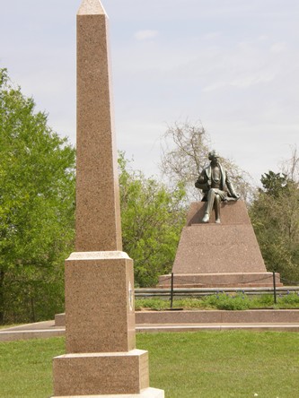
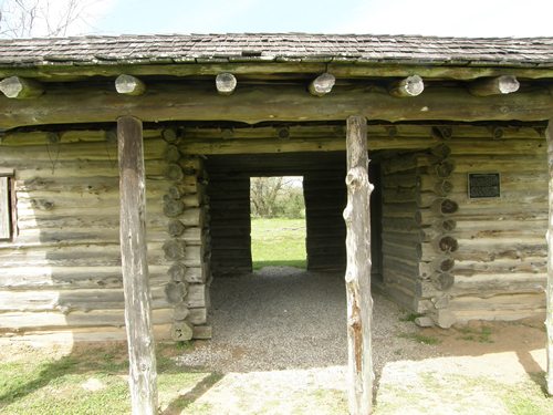
San Felipe
de Austin State Historic Site
|
On the northern
part of town.
Several replica buildings have been erected around the old town site
on the Brazos to form the San Felipe de Austin State Historic Site.
Built in the late 1920s, the park was donated to the state in 1940.
An obelisk and a (seated) bronze statue of Stephen
F. Austin dominate the site while a rebuilt-well and the aforementioned
buildings finish off the �infrastructure� of what is actually a 4,200
park.
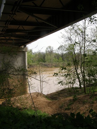
The bridge on FM 1458 crosses the Brazos over the site of the original
ferry. |
|
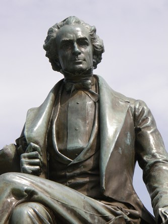
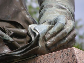
The statue of
Stephen Fuller
Austin was commissioned in 1938.
The sculptor was Englishman John Angel (1881-1960)
|
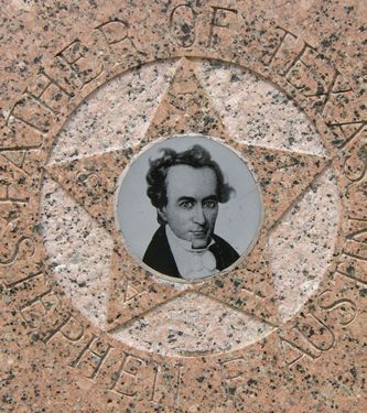
Centennial Marker:
Stephen F.
Austin
Stephen
F. Austin, Father of Texas, November
3, 1793-December 27, 1836. He planted the first Anglo-American colony
in Texas, "The
Old Three Hundred". In his several colonies he settled more than
a thousand families. He was from 1823 until 1828 the actual ruler
of Texas and thereafter its most influential
leader. His own words are a fitting epitaph: "The prosperity of Texas
has been the object of my labors -- the idol of my existence -- it
has assumed the character of a religion -- for the guidance of my
thoughts and actions" -- and he died in its service. No other state
in the union owes its existence more completely to one man than Texas
does to Austin.
Erected by the State of Texas 1936 with funds appropriated
by the Federal government to commemorate one hundred years of Texas
independence. |
| A rather wind-blown
portrait of Stephen
Austin is mounted on the granite obelisk |
Historical Marker:
Replica of Stephen F. Austin's Cabin
Built in 1954, this structure is a replica of the only Texas home
of Stephen F.
Austin, "Father of Texas." The chimney contains bricks from original
(1828) cabin. Other materials were made as authentically as possible.
Austin (1793-1836)
opened the Anglo-American colonization of Texas. His cabin, located
in capital city of San Felipe, welcomed pioneers and statesmen of
era; witnessed many crucial events leading to Texas Revolution.
Recorded Texas Historic Landmark (1970) |
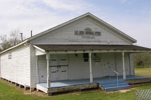
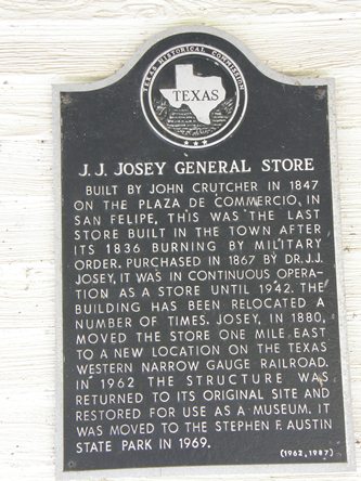
| The J. J. Josey
General Store historical marker |
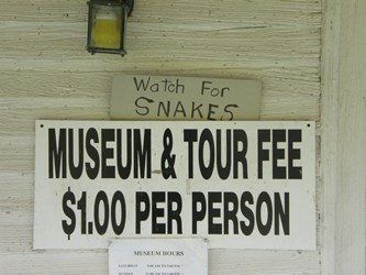
| Free (if you
bring in a snake). |
|
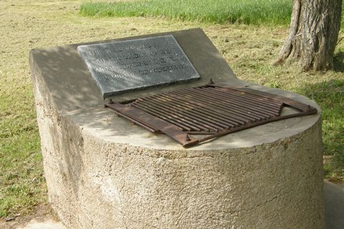
"A city
may be moved - but not a well" - the I Ching
The original community well, was rebuilt in 1928, before the park
was donated to the state.
|
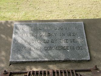
| "Restored
by the Sealy Chamber of Commerce - 1928" |
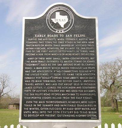
| "Early Roads
to San Felipe" historical marker |
Historical Marker
Early Roads to San Felipe
During the mid-1820s, when Stephen
F. Austin was founding this town, the only roads in the area were
wagon ruts of beaten trails marked by notched trees. Within a decade,
however, the village of San Felipe, one of the first Anglo settlements
in Texas, had become a hub from which 8 or more roads projected.
Many of these were small, intra-colony routes, but the main trails
extended to major towns or joined "highways", such as the San Antonio
Road (El
Camino Real). A main route which passed through San Felipe was
the Atascosita Road, connecting Goliad
with the United States. It took its name from Atascosa (Spanish for
"boggy") Spring near Liberty,
which once was its main terminus. The Gotier Trace, another travel
artery, was laid out about 1830 by pioneer James Gotier. It joined
the northern and southern parts of Austin's colony and was used for
decades. The San Felipe Road proper, which ran to Harrisburg, transported
goods inland from the Gulf
Coast.
Even the main thoroughfares, however, were dusty trails in the summer
and impassable quagmires in the winter, often flooded by knee-deep
water. Not until well into the 20th century did Texas begin to develp
her present, outstanding highway system.
(1969) |
 |
|
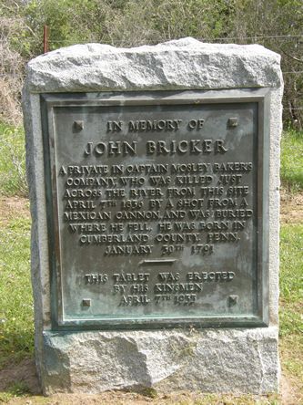
"Killed
by a Mexican Cannon" - "Buried where he fell"
Marker for Private John Bricker, native of Pennsylvania
|
| A view from under
the bridge - the site of the original ferry. |
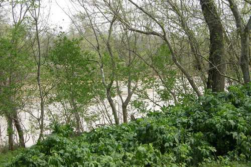
| South bank of
the Brazos River - with freshly sprouted bloodweed. |
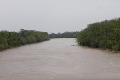
| View of the Brazos
River from the bridge |
|
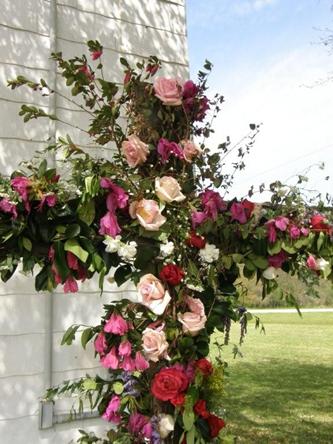
A beautiful
Easter Cross at
the San Felipe Methodist Church
TE photos, March 2008
|
Stephen
F. Austin State Park
Deeded by the San Felipe de Austin Corporation in 1940
Park Road 38
San Felipe, TX 77473-0125
(979) 885-3613
http://tpwd.texas.gov/state-parks/stephen-f-austin |
| Texas
Escapes, in its purpose to preserve historic, endangered and vanishing
Texas, asks that anyone wishing to share their local history
and vintage/historic photos, please contact
us. |
|
|
 Texas
Gulf Coast
Texas
Gulf Coast East
Texas
East
Texas Central
Texas North
Central
Texas North Central
Texas South
Central
Texas South Texas
Panhandle
Texas
Panhandle South
Texas
South
Texas Texas
Hill Country
Texas
Hill Country West
Texas
West
Texas Texas
Ghost Towns
Texas
Ghost Towns Texas
Counties
Texas
Counties